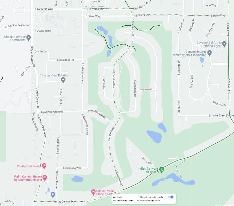
Canyon Country Club Bike Route
South Palm Springs is one of the best places in the city to experience Palm Springs the way it was meant to be seen: slowly, in the sunshine, with mountain views and midcentury architecture around every corner. This self-guided bike tour winds through some of the city’s most iconic residential neighborhoods, historic golf resorts, and beautifully preserved modernist communities, all on mostly flat, paved streets.
It’s a relaxing, easy ride that blends architecture, celebrity history, and desert scenery into one unforgettable Palm Springs experience.
At-a-Glance Ride Info
- Distance: ~5 miles
- Estimated riding time: 45 minutes (not including stops)
- Difficulty: Easy
- Terrain: Paved neighborhood streets
- Best for: Architecture lovers, casual riders, photographers, history fans
This route is ideal for a morning ride, a winter afternoon cruise, or anyone wanting to explore Palm Springs beyond downtown.
Why This Ride Belongs on Every Palm Springs Itinerary
This tour blends three things Palm Springs does better than almost anywhere else:
midcentury design, resort-era history, and outdoor lifestyle. It’s an easy, immersive way to experience the city beyond downtown — and one of the best introductions to South Palm Springs for first-time visitors.
What You’ll Experience on This Ride
This self-guided tour showcases the lifestyle that helped define Palm Springs in the 1950s–1970s:
- Midcentury modern condo communities and neighborhoods
- Historic golf courses on Agua Caliente land
- Celebrity-era Palm Springs resort scenery
- Mountain backdrops, palm-lined streets, and famous colored doors
- Quiet residential roads are perfect for cycling
Along the way, you’ll pass architectural gems designed by some of Palm Springs’ most important modernist architects, plus sites connected to Hollywood history and the city’s golfing legacy.
Getting Started
Take South Palm Canyon Drive to La Verne Way and park on the street near Calle Palo Fierro.
Begin by heading east on La Verne Way, then turn right on Calle Palo Fierro.
Highlights Along the Route
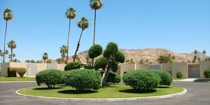
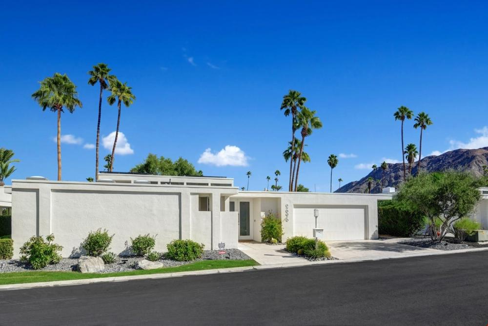
Canyon Country Club Colony (1964)
Located on over six acres of fairways and lakes, this iconic condo community sits beside what is now Indian Canyons Golf Resort. Built in 1964, the 38-unit development is one of South Palm Springs’ most recognizable midcentury residential enclaves.
Turn left at Avenida Granada and left again at Camino Real.
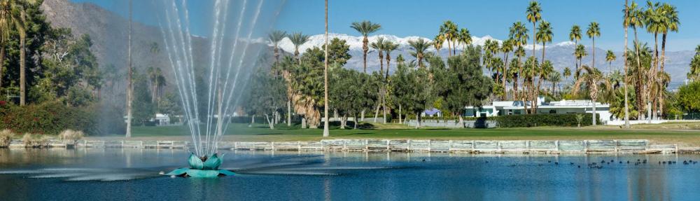
Indian Canyons Golf Resort & the Disney Fountain
Turn right on Yosemite Drive, then right on Sequoia Place, riding with the golf course on both sides.
Look for a large fountain in the middle of the golf course, in the distance behind the homes.
Turn right on Sequoia Place and pass by the golf course on both sides.
The fountain should be visible on your left. This fountain was a gift from Walt Disney, who once owned property in the area. The surrounding golf grounds were famously frequented by celebrities such as Frank Sinatra, Bob Hope, and Jackie Gleason, and by U.S. presidents including Dwight D. Eisenhower, Lyndon B. Johnson, and Ronald Reagan.
Turn left at Alhambra Drive, then left at Camino Real to finish the loop and head south to Murray Canyon Drive.
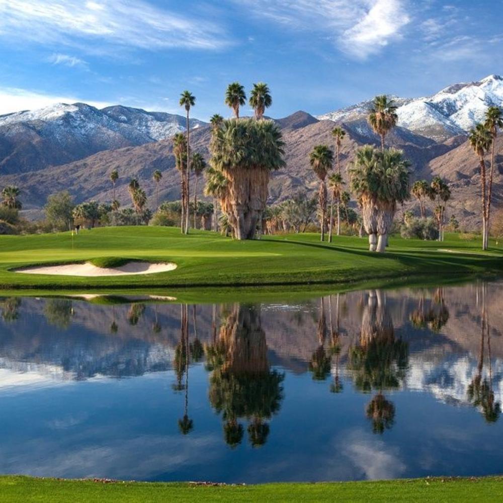
Indian Canyons Golf Resort
Turn left on Murray Canyon Drive.
Indian Canyons Golf Course is on your right. The 36-hole Indian Canyons Golf Resort spreads across 550 acres of Agua Caliente land and has been a centerpiece of Palm Springs recreation since 1961. It remains one of the most historically significant golf landscapes in the Coachella Valley.
Kings Point by William Krisel
On your left is Kings Point, a collection of 44 architecturally significant midcentury homes designed by legendary Palm Springs architect William Krisel. This neighborhood is a must-see for modernism fans.
Veer left at South Toledo Avenue.
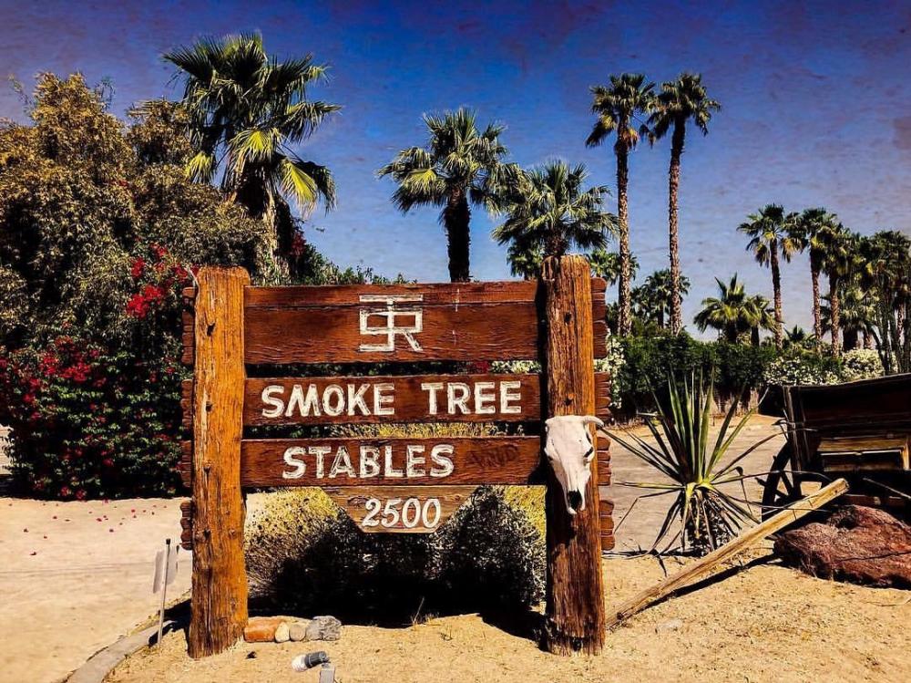
Smoke Tree Stables
On your right, you’ll pass Smoke Tree Stables, a family-owned Palm Springs institution operating for more than 75 years. Located at the base of desert trails, it’s a great option if you want to pair your ride with a guided horseback adventure.
Continue on South Toledo to Canyon Estates Drive.
Turn left at Madrona Drive and follow it to Paseo Del Rey.
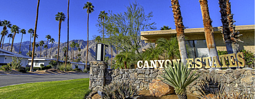
Canyon Estates (Charles Du Bois)
Canyon Estates offers classic midcentury modern architecture and design. The architect was Charles E. Du Bois, and the developer was Roy Fey, in conjunction with Great-West Life Assurance Company of Canada. Great-West Life obtained the lease on Agua Caliente Indian land when the original lessee and developer went out of business. Construction began in the late 1960s, and models were open for viewing in 1970.
Turn left at Sierra Way and cross the north end of the golf course.
Turn right on Calle Palo Fierro.
Turn left at La Verne to return to where your bike ride through South Palm Springs began.
Self-Guided Bike Tour of South Palm Springs Ends
Tips for a Great Ride
- Go early in warmer months for cooler temps and softer light
- Bring water and sun protection — shade is limited
- Ride slowly and respect residential neighborhoods
- Plan time to stop for photos — this route is extremely photogenic
- Pair it with brunch, lunch, coffee, or a spa stop nearby
Frequently Asked Questions: South Palm Springs Self-Guided Bike Tour
Is this a good bike ride for beginners?
Yes. This is an easy, mostly flat ride on paved neighborhood streets. It’s well-suited for casual riders, first-time visitors, and anyone who wants a relaxed, scenic experience rather than a workout.
Do I need a special bike?
No special equipment is required. A standard cruiser, hybrid, or e-bike works perfectly. Because this route is flat and paved, it’s ideal for rental bikes.
Where can visitors rent bikes in Palm Springs?
Bike Palm Springs Rentals & Tours downtown offers cruisers, e-bikes, and guided options.
Is this ride good in summer?
Yes, but it’s best to ride early in the morning during summer. Bring water, sunscreen, and consider an e-bike to reduce exertion.
Are there places to stop along the way?
Yes. You’ll pass golf resorts, architectural neighborhoods, Smoke Tree Stables, and scenic areas that are perfect for short breaks. Many riders pair this tour with brunch, coffee, or lunch in South Palm Springs or downtown afterward.
What makes this area special?
South Palm Springs is one of the city’s richest areas for midcentury modern architecture, historic golf resorts, and celebrity-era neighborhoods. This route showcases multiple architecturally significant communities and landscapes tied to Palm Springs’ modern identity.
Can this be combined with other self-guided tours?
Absolutely. This ride pairs well with:
- Midcentury architecture self-guided driving tour
- Palm Springs Self-Guided Colored Doors Tour
- Historic Tennis Club Neighborhood Self-Guided Tour
- Downtown Palm Springs Art Walking Tour
Explore the Nature & Outdoors Guide.