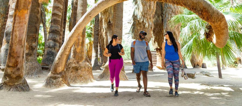
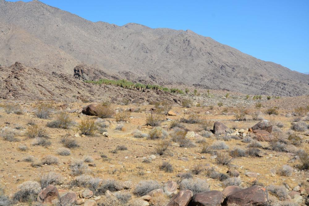
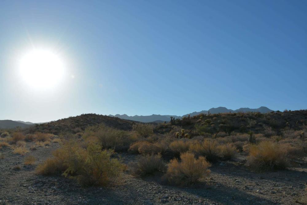
Indian Canyons is a beautiful nature reserve in South Palm Springs. The Agua Caliente Band of Cahuilla Indians owns and cares for this ancient sacred reservation land. It spans over 31,500 acres and is home to breathtaking canyons, unique rock formations, and lush vegetation.
Indian Canyons' history dates back thousands of years, when the Agua Caliente Band of Cahuilla Indians settled in the area. The Cahuilla people have a long and rich history in the region, utilizing the canyons as a primary source of water and food. They also believed that the canyons contained powerful spirits that protected their tribe.
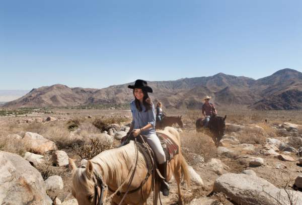
In the early 1900s, the Agua Caliente Tribe began to protect its sacred land, and Indian Canyons were designated as a nature reserve in 1969. Today, visitors can explore the canyons on foot or horseback, experience the area's natural beauty, and learn about the history and culture of the Cahuilla people.
Indian Canyons has several hiking trails, including Andreas Canyon, Murray Canyon, and Palm Canyon. Each trail offers a unique experience and stunning views of the canyons and the surrounding landscape. It is a beautiful and important nature reserve that offers visitors a unique glimpse into the history and culture of the Agua Caliente Band of Cahuilla Indians. It features more than 60 miles of hiking trails.
You enter Indian Canyons via South Palm Canyon. You will come to a toll booth where you will pay your fee to enter. Then, all Indian Canyons are accessible, and you will see signage directing you to the three canyons.
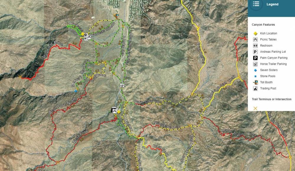
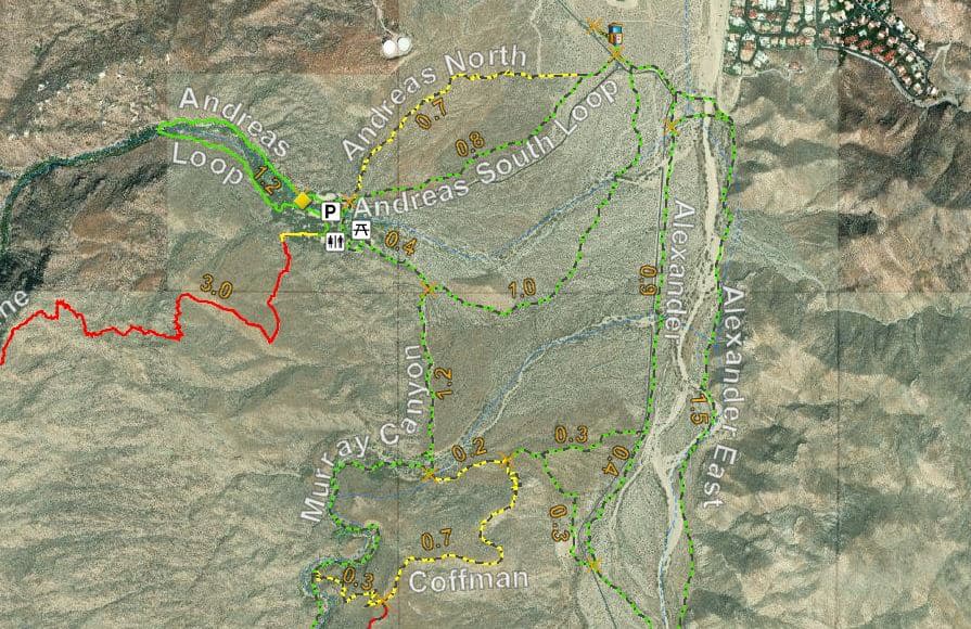
Andreas Canyon Trails
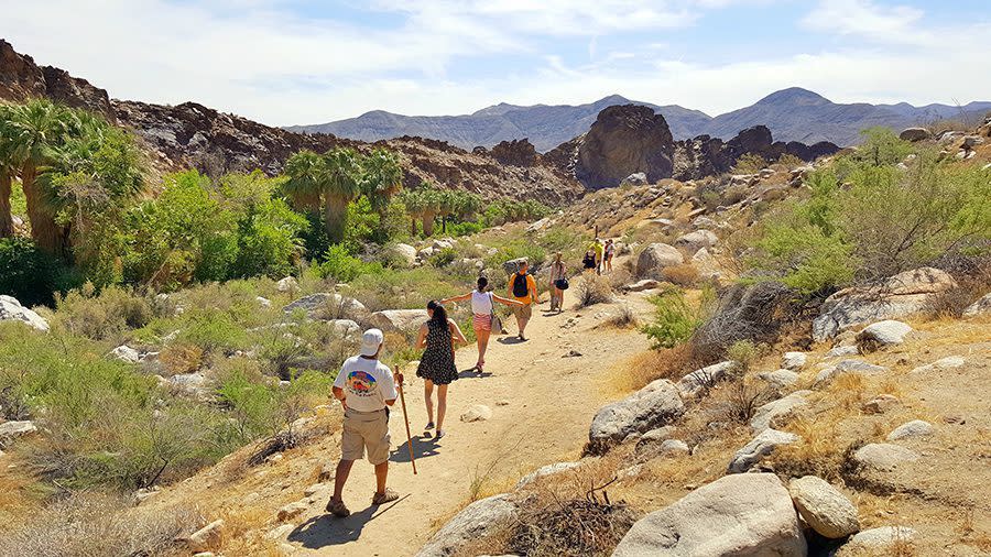
You can walk along the trails that wind through the canyon and marvel at the stunning rock formations and lush vegetation. The canyon also boasts several natural pools and streams, making it a popular spot for hiking, picnicking, and relaxing in the shade.
Andreas Canyon is also home to a diverse array of wildlife, including bobcats, coyotes, and numerous bird species. Please remember the park's guidelines and avoid feeding or disturbing any animals. It’s also recommended to wear closed-toe shoes rather than sandals.
Andreas Canyon Loop
- Distance: 1 mile (round trip)
- Hiking Time: 30-40 minutes
- Hike Level: Easy
- Elevation Gain: 200 feet
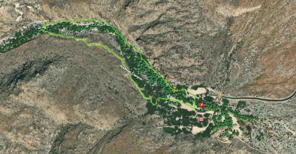
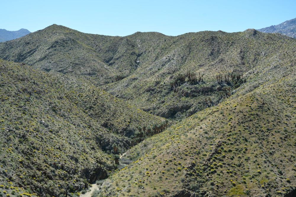
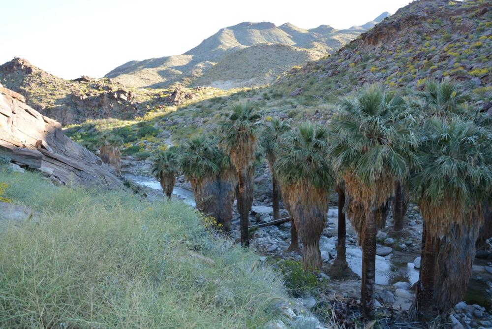
Andreas Canyon is considered the world’s second-largest California Fan Palm oasis. Ancient rock mortars adorning the entrance to the canyon remind visitors of the presence of the first people. The trail begins at the Trail Information Board, located just north of the bridge. It leads west along the north side of the perennial Andreas Creek for ½ mile, then it crosses the creek at the fence and returns along the upper stream terrace to the parking area. Hikers will be rewarded with spectacular views of rock formations, sycamores, cottonwoods, willows, and the magnificent California Fan Palm (Washingtonia filifera), all surrounded by the harsh desert environment.
Andreas Canyon North & South Trails
- Distance: 2 to 2½ miles
- Hiking Time: 30 minutes
- Hike Level: North: Moderate | South: Easy
- Elevation Gain: 200 feet
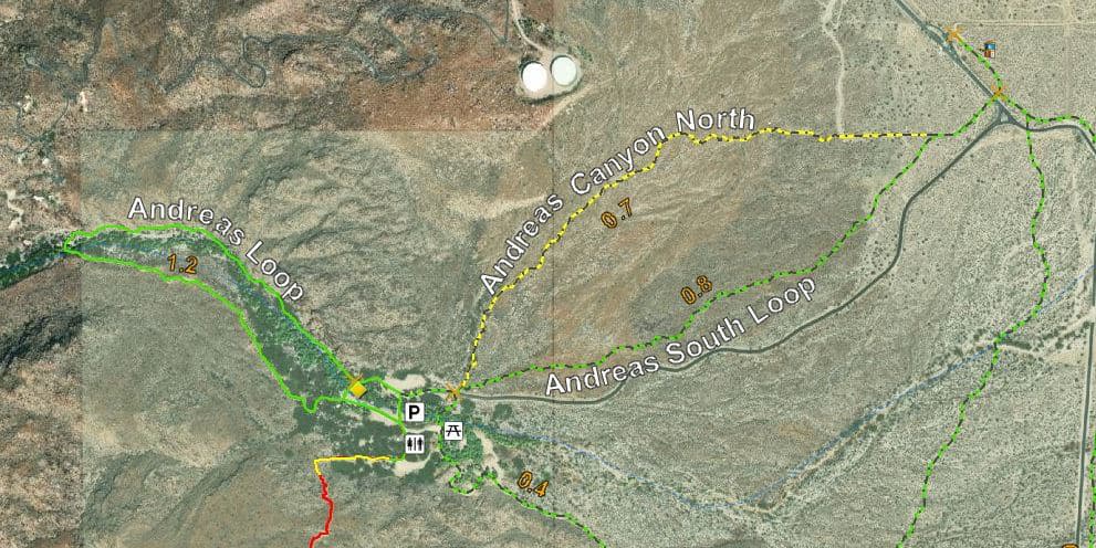
Combining these two trails creates a pleasant loop excursion for hikers. These trails connect the equestrian entrance gate to the Andreas Canyon parking area. They cross the alluvial fan of Andreas Canyon, which offers glimpses of desert flora and geology, as well as panoramic views of the Canyon. You can begin on either the north or south loop.
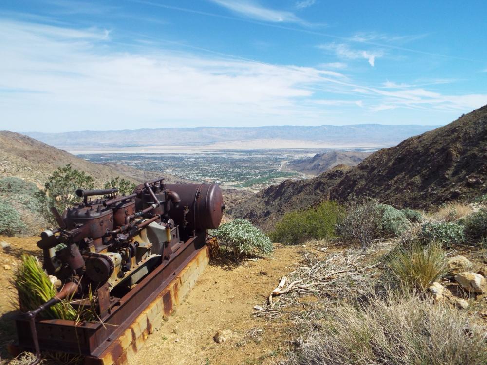
Maynard Mine Trail
- Distance: 6 miles (round trip)
- Hiking Time: 5 hours
- Hike Level: Strenuous
- Elevation Gain: 2,080 feet
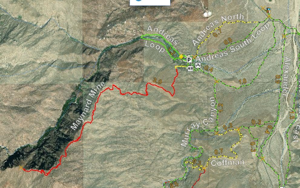
The Maynard Mine Trail originally served as an access route for a tungsten mine located on the ridge between Andreas Canyon and Murray Canyon. The trailhead is located south, just across the bridge in the Andreas Canyon parking area. Heading west, the trail ambles lazily for 1.4 miles before climbing sharply to the top of the ridge separating Murray and Andreas Canyons. The trail then drops down for ½ mile over the ridge to the razorback ridge, where the end of the trail sign is located. The mine entrance can be found over the north edge of the ridge, about 200 feet from the end of the trail sign.
Did you know?
The skirts of the California fan palms that line Andreas Canyon Loop were used to construct the shelter, known in the Cahuilla language as Kish. You can see a replica of this traditional Cahuilla shelter form inside the canyon.
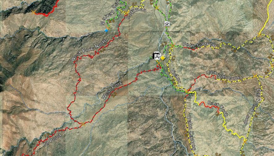
Murray Canyon Trails
The hike is not overly strenuous, making it accessible to most hikers. The trail follows a stream through the canyon, offering stunning views of the surrounding mountains and vegetation. Hikers can expect to see a variety of desert plants, including palm trees, cacti, and wildflowers.
One of the highlights of the Murray Canyon trail is the Seven Sisters Waterfall. This series of waterfalls is named after the seven rocky peaks surrounding them. The falls are awe-inspiring during the spring months when the water flow is at its highest.
Murray Canyon Loop Trail
- Distance: 4 miles (round trip)
- Hiking Time: 2 hours
- Hiking Level: Easy
- Elevation Gain: 500 feet Seasonal 12-Foot Waterfall
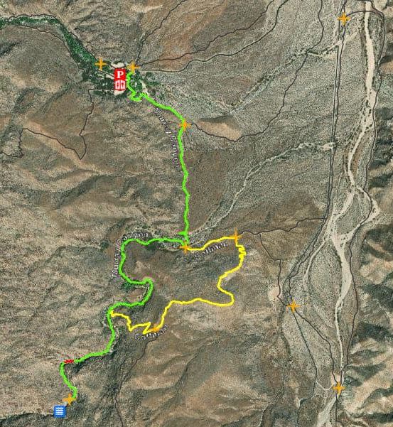
Murray Canyon Creek is seasonal. Water runs through the canyon only during the winter and spring months. The trailhead is located at the south end of the Andreas Canyon parking area. From there, the trail leads the hiker one-half mile across the open desert, at the foot of spectacular rock formations, to the mouth of Murray Canyon. The trail winds through the canyon, crossing the stream several times for 1½ miles, ending at Seven Sisters, where a 12-foot waterfall greets the hiker.
Coffman Trail
- Distance: 1 ¼ miles
- Hiking Time: 45 minutes
- Hiking Level: Moderate
- Elevation Gain: 400 feet
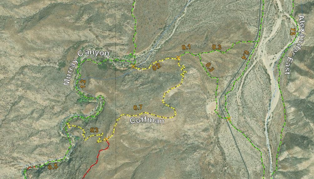
The Coffman Trail offers hikers northern access to the West Fork North Trail. Access is from the Murray Canyon Trail. Follow the Murray Canyon Trail 1¼ miles to its junction with the Coffman Trail, and then continue to a stunning saddle offering superb desert views. The Coffman Trail can make a loop back to Andreas Canyon.
Alexander Trail & Alexander East Trail
- Distance: Alexander Trail: 1¼ mile
- Alexander East Trail: 1½ mile
- Hiking Time: 45 minutes
- Hiking Level: Easy
- Elevation Gain: Alexander Trail - 105 feet | Alexander East Trail - 180 feet
The trail provides riders access from the equestrian entrance at the tollgate to the Murray Canyon, Fern Canyon, Victor, and Palm Canyon trails. The Alexander Trail parallels Palm Canyon Road to the Horse Trailer Parking area. The Alexander East Trail travels along the base of the Santa Rosa Mountain Range to the Fern Canyon Trail Junction. This trail is a great option for those seeking a moderately challenging hike with plenty of scenic vistas and natural wonders to discover.
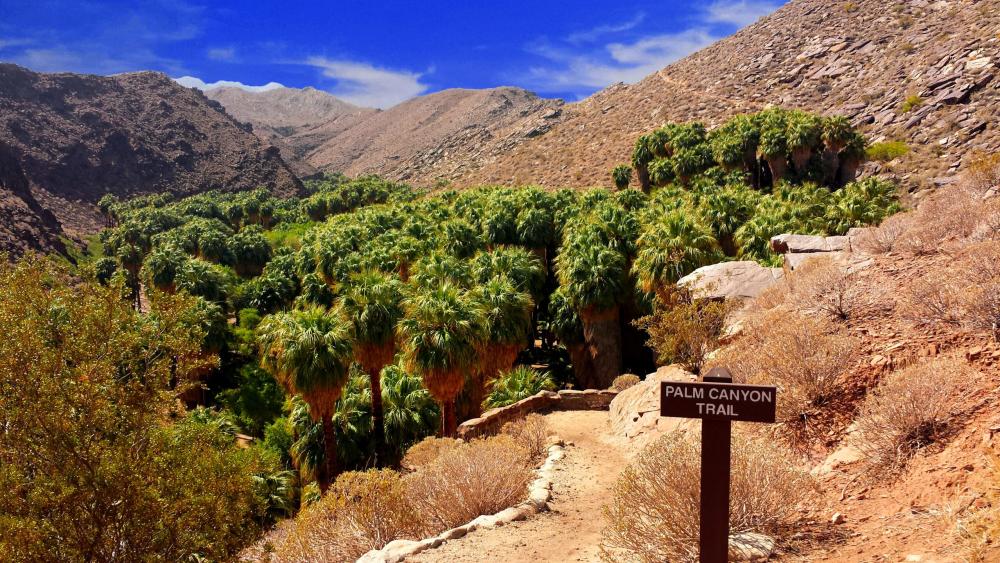
Palm Canyon Trails
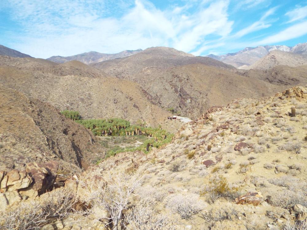
As the world’s largest naturally occurring oasis of Washingtonia filifera palm trees, this canyon couldn’t be more aptly named. The canopy of green fronds provides a breathtaking contrast to the surrounding rocky gorges. Be sure to stop inside the Trading Post near the parking lot. Besides refreshments and hiking maps, you’ll find Native American art, books, jewelry, pottery, baskets, and more.
Palm Canyon Trail
- Distance: 15 miles (one way to Hwy 74)
- Hiking Time: Up to 8 hours (depending on distance)
- Hiking Level: Moderate
- Elevation Gain: 3,520 feet
Hike through the world’s largest California Fan Palm oasis. Visitors to Palm Canyon walk through majestic groves of California Fan Palms and travel along the picturesque Palm Canyon Creek. Rock mortars seen along the creek indicate the village sites of the Cahuilla Indians who lived in this canyon. The Palm Canyon Trail begins at the Trading Post and provides hikers access to the many trails of varying lengths, leading hikers to remote areas of the canyon. Trails accessible from the Palm Canyon Trail include the West Fork Trail, East Fork Trail, Victor Trail, Vandeventer Trail, Dry Wash Trail, and the Indian Potrero Trail.
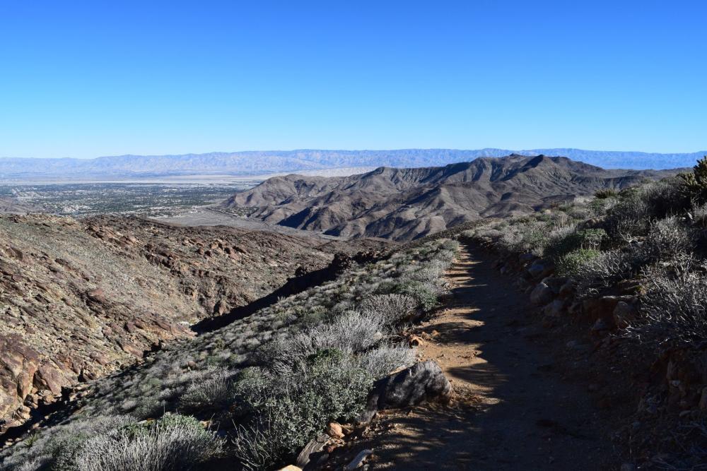
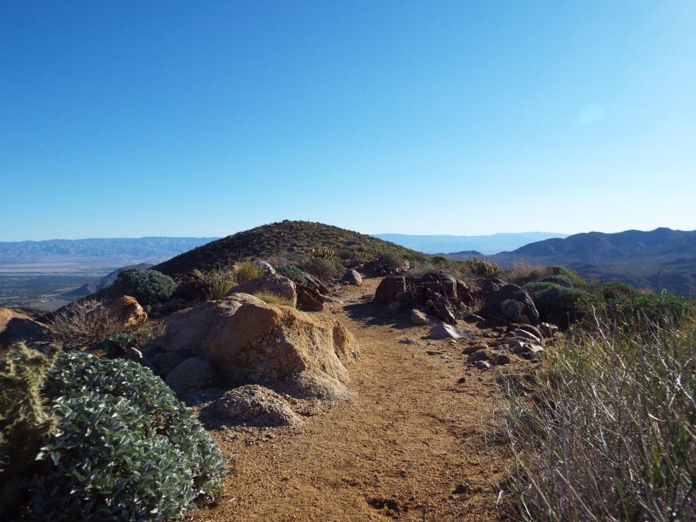
Victor Trail
- Distance: 3-mile loop
- Hiking Time: 1½ hours
- Hiking Level: Moderate
- Elevation Gain: 250 feet
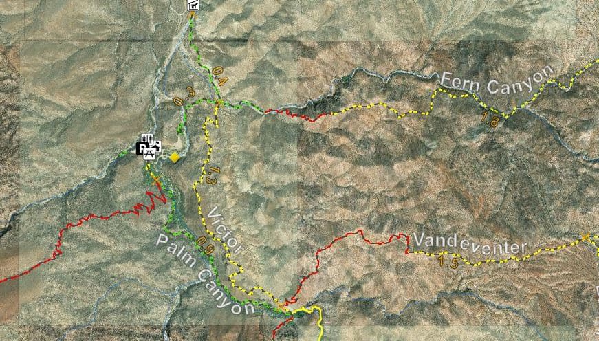
This trail is one of the most scenic trails in the Indian Canyons. It is best to access this trail by hiking a mile south on the Palm Canyon Trail. The Victor Trail will take you out of the shade of the palm trees, up and onto the ridge that overlooks the canyon, and return the hiker to the Trading Post, making a three-mile loop. In the image below, you see the trading post in the distance.
East Fork Trail
- Distance: 3 miles (from Trading Post to East Fork Loop Trail junction)
- Hiking Time: 1½ hours
- Hiking Level: Moderate - Strenuous:
- Hike Elevation Gain: 550 feet
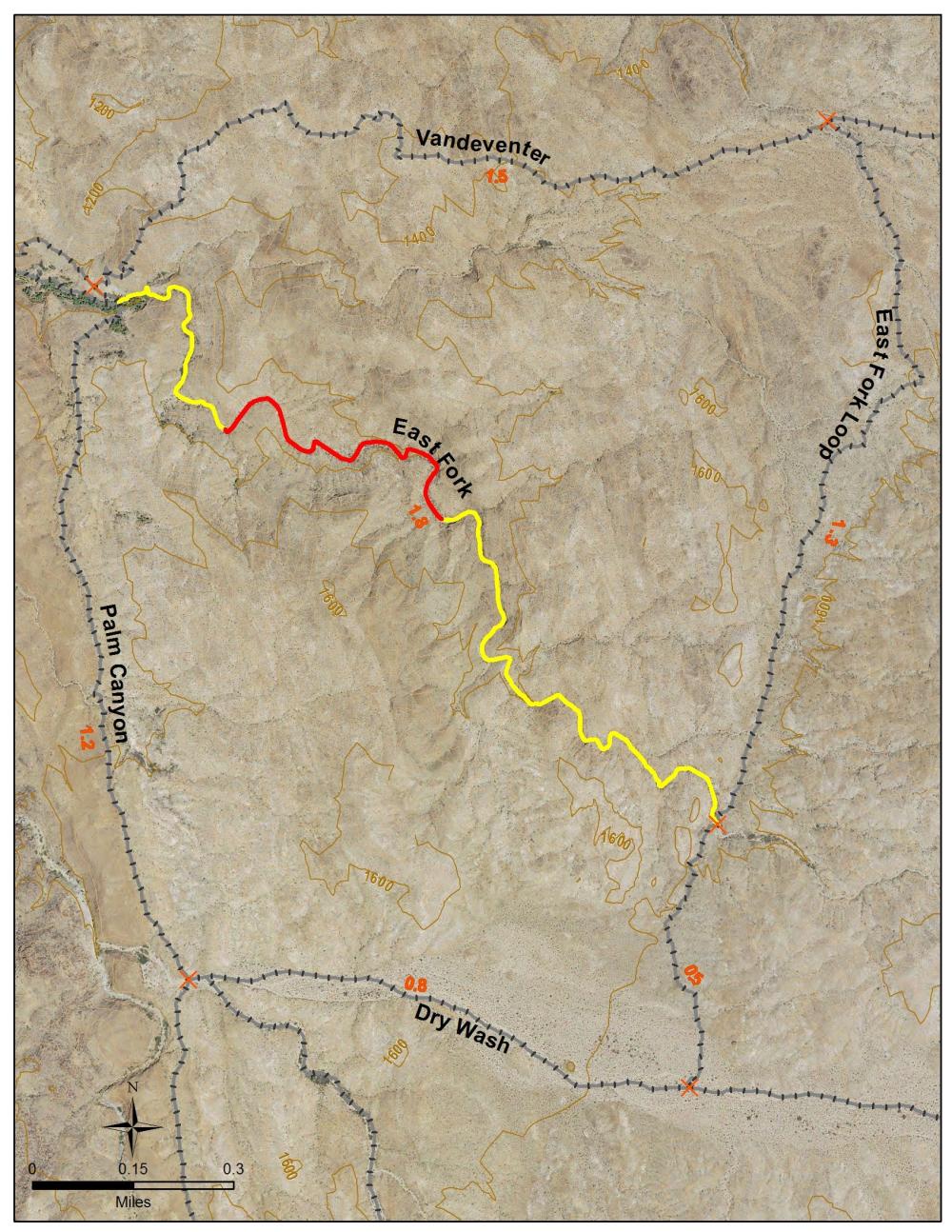
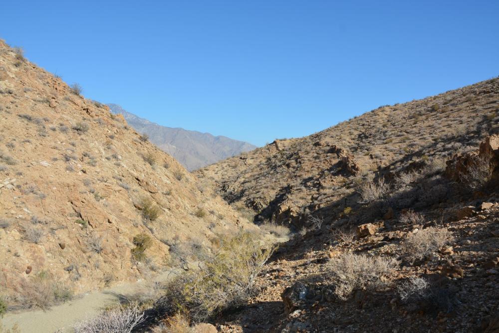
This trail leads hikers to a seldom-seen part of the Indian Canyons. It meanders through the narrow wash of the East Fork of the Palm Canyon Creek with its towering walls on all sides. Vast patches of Teddybear Cholla and agave can be seen along the trail. Access the trail one mile south of the Trading Post on the Palm Canyon Trail. Through the East Fork, hikers can create a loop by following the East Fork Loop Trail to the Dry Wash Trail and then back to the Palm Canyon Trail, or they can proceed north by using the East Fork Loop Trail to connect with the Vandeventer Trail.
Did you know?
West Fork Falls, one of the most accessible waterfalls in the Indian Canyons, lies only 340 feet from the Trading Post parking lot. Best viewed from December to March, the waterfall flows from an opening between two massive boulders wedged tightly together, collecting in a small pool.
Dry Wash Trail
- Distance: 3 miles from Palm Canyon to Dunn Road
- Hike Level: Easy
- Elevation Gain: 850 feet
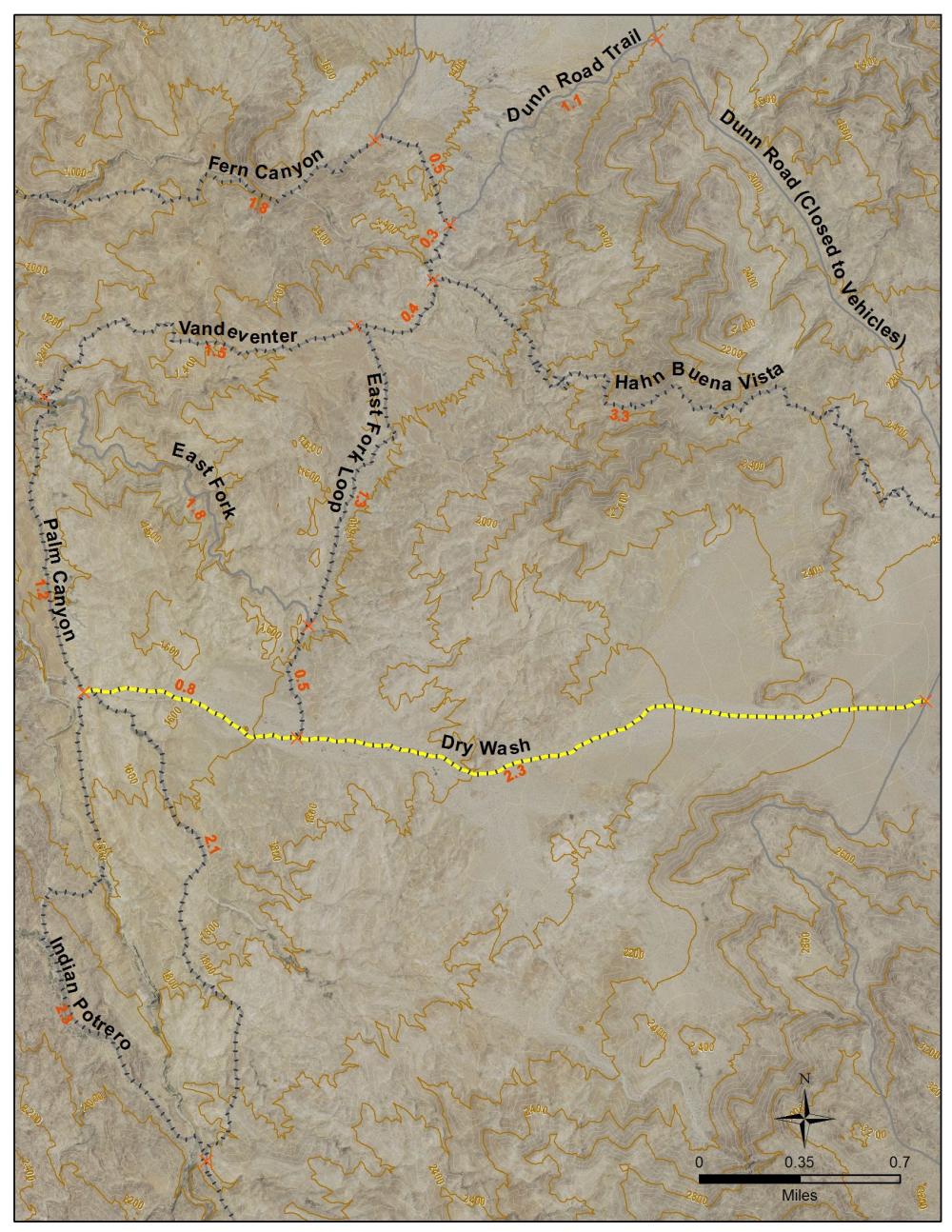
The best way to access the Dry Wash Trail is to take the Palm Canyon Trail south for 2 ½ miles. The Dry Wash Trail connects the Palm Canyon Trail and Dunn Road. It provides access to the East Fork Loop Trail.
Vandeventer Trail
- Distance: 2 miles Hiking
- Time: 1-½ hours
- Hiking Level: Moderate - Strenuous
- Elevation Gain: 500 feet
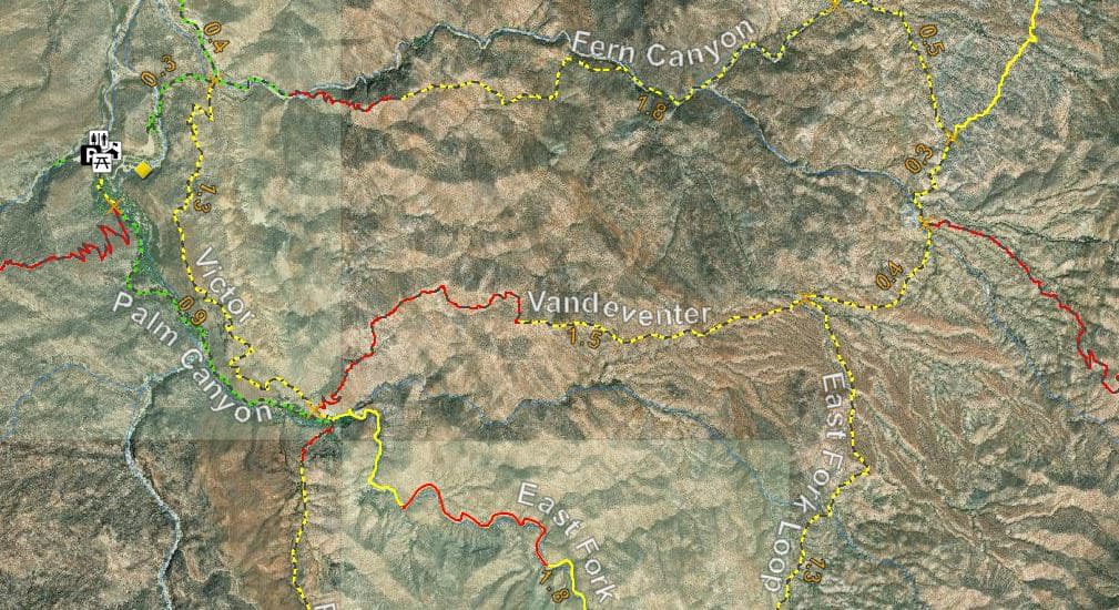
The Vandeventer Trail is accessed from the Victor Trail or the Fern Canyon Trail. It connects the Fern Canyon Trail at the junction of the Dunn Road Trail. For an incredibly picturesque hike, guests can create a 6-mile loop by taking the Fern Canyon Trail and the Vandeventer Trail, then returning on the Palm Canyon Trail to the Trading Post. The Vandeventer Trail also provides access to the Hahn Buena Vista Trail, East Fork Loop Trail, and Victor Trail.
Fern Canyon Trail
- Distance: 2-¼ miles to Fern Canyon (one way)
- Hiking Time: 1 hour
- Hiking Level: Moderate - Strenuous
- Elevation Gain: 600 feet
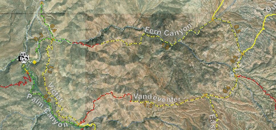
The Fern Canyon Trail is accessible from the lower parking area of Palm Canyon. The trail leads up to a ridge that overlooks Fern Canyon before it takes the hiker to the maidenhair ferns that cover an overhang in the canyon. Along the ridge, the hiker is treated to a spectacular sight of various desert plants that cover the area. At one time, water dripped from the face of the overhang, enabling the ferns to cover the entire rock face in a sea of green. It is a cool place to enjoy because it is always shady under the ferns. Just past the outcrops of ferns, the trail connects to the Vandeventer Trail, providing a 6-mile loop for the hardy hiker.
Indian Potrero Trail
- Distance: 8 miles (round trip)
- Hiking Time: 4 ½ hours
- Hiking Level: Moderate
- Elevation Gain: 540 feet
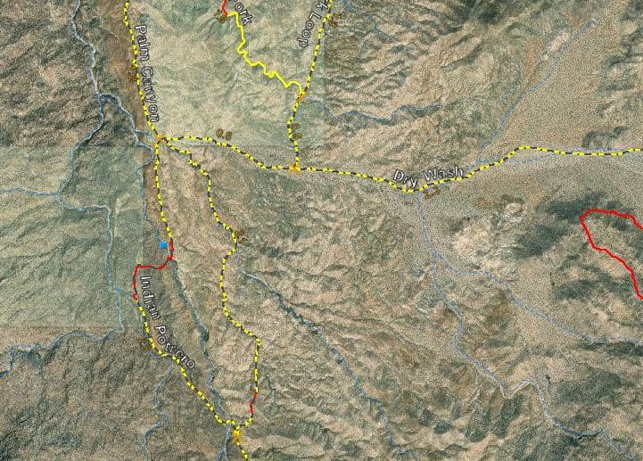
This trail begins at the junction of the Palm Canyon Trail and Dry Wash Trail, about 2 miles south of the Trading Post. It leads to the upper region of Palm Canyon, where a series of stone pools await the hiker. It then takes the hiker up through a hidden plateau surrounded by rock formations, which create a natural pasture. The Indian Potrero Trail connects with the Palm Canyon Trail at the end of the pasture area. Taking the Palm Canyon Trail back to the Trading Post makes an 8-mile hike, and the hiker will be greeted with patches of agave, ocotillo, and the Teddybear Cholla.
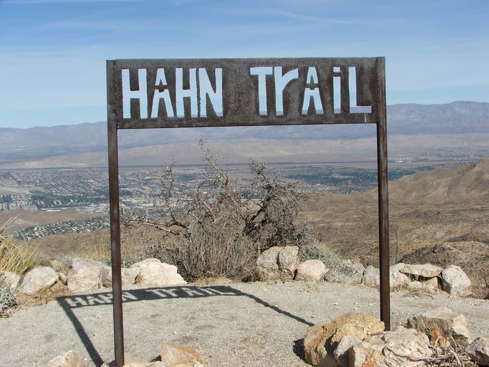
Hahn Buena Vista Trail
- Distance: 11½ mile loop
- Hiking Time: 6 hours
- Hiking Level: Strenuous
- Elevation Gain: 1,250 feet
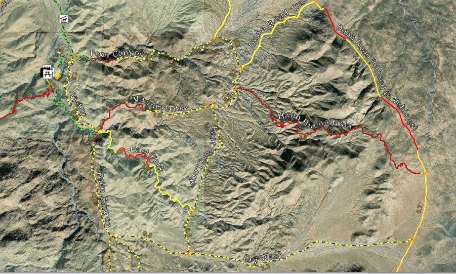
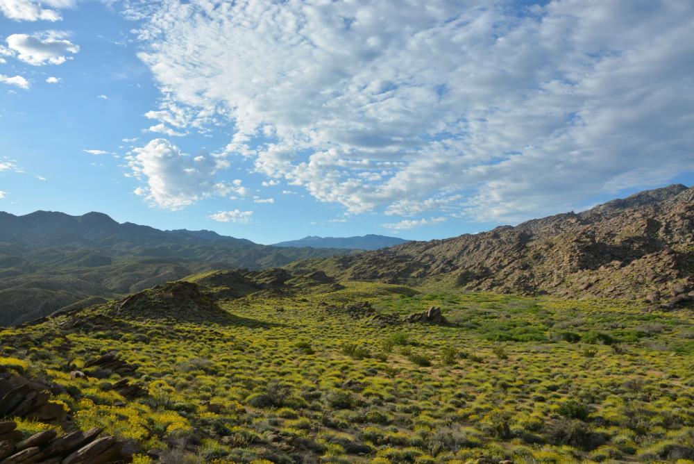
This stunning trail is one of the most scenic high-country trails in the Santa Rosa Mountains. At the peak, the trail offers a 360-degree view of the desert cities and the surrounding mountains. A challenging hike is to make an 11½ mile loop by taking the Fern Canyon Trail, the Dunn Road Trail, and the Dunn Road, then return by the Hahn Buena Vista Trail to the Vandeventer Trail and the Palm Canyon hike to the Trading Post. Only conditioned hikers should attempt this trail.
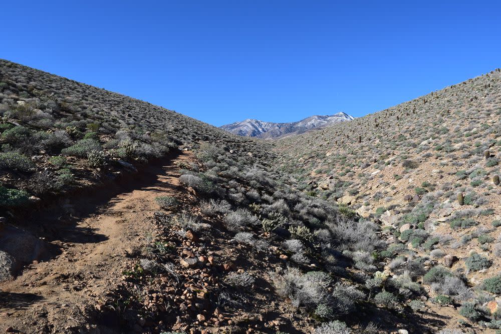
West Fork Trail
- Distance: 5 miles (round trip)
- Hiking Time: 3 hours
- Hiking Level: Strenuous
- Elevation Gain: 1,400 feet
This strenuous hike climbs nearly 1,400 feet in a relatively short distance, but the rewards are worth it. Breathtaking views await the well-conditioned hikers who make it. If you keep a sharp eye, you may be lucky and see the elusive mule deer or the shy Bighorn sheep. This trail is accessed from the Palm Canyon Trail about 900 feet South of the Trading Post. The West Fork Trail ends at the junction of the Jo Pond and West Fork North Trails.
West Fork North Trail
- Distance: 9-mile loop
- Hiking Time: 5 hours
- Hiking Level: Strenuous
- Elevation Gain: 1,500 feet
The West Fork North Trail is best enjoyed by combining the West Fork, West Fork North, Coffman, Murray Canyon, and Alexander Trails into a 9-mile loop. It’s best to access the West Fork North Trail from the West Fork Trail. Hike up the West Fork Trail from Palm Canyon for 2½ miles to the trail junction of the Jo Pond and West Fork North Trails. Turn right or north for the West Fork North Trail, or go straight or west for the Jo Pond Trail. The West Fork North Trail will take you up to a spectacular overview of the entire Indian Canyons at 2,600 feet. The West Fork North Trail then heads downhill to the Coffman Trail that leads to the Murray Canyon Trail and service road, and on to the Alexander Trail or Palm Canyon Road, and then back to the Trading Post parking area. Only conditioned hikers should attempt this trail.
Jo Pond Trail
- Distance: 18 miles (round trip)
- Hiking Time: 9 hours
- Hiking Level: Strenuous
- Elevation Gain: 4,600 feet
The Jo Pond Trail continues the West Fork Trail and culminates at the Pacific Crest Trail atop Garnet Ridge. Meandering vigorously through dramatic relief, the trail gains nearly 4,600 feet of elevation. Explorers on the Jo Pond Trail experience a "palms to pines" progression of ecosystems as they ascend from the desert into the mountains. On clear days, panoramic vistas of the Coachella Valley and the Salton Sea await hikers. This is one of the most impressive trails in the region.
Images Credit: Indian Canyons
👉 The Waterfalls of Palm Springs Canyons
👉 A Cultural Oasis in the Desert