Everything You Need to Know About Hiking San Jacinto Peak from Palm Springs
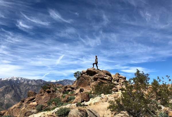
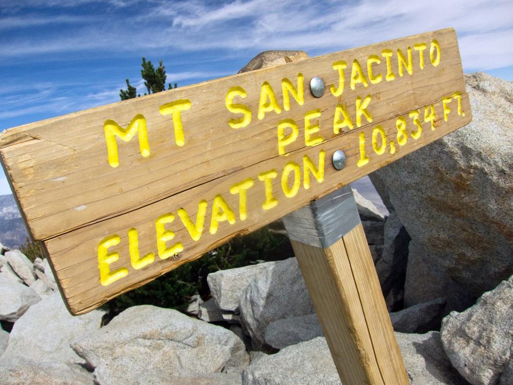
Mount San Jacinto Peak, rising to 10,834 feet, is the highest summit in the San Jacinto Mountains and one of the most rewarding hikes in Southern California. Located just minutes from downtown Palm Springs, this iconic trail delivers dramatic elevation gain, alpine scenery, and a rare opportunity to experience multiple climate zones in a single day.
Hiking San Jacinto Peak via the Palm Springs Aerial Tramway is the most popular and accessible route to the summit, allowing hikers to start at high elevation while avoiding the extreme desert heat below. Along the way, hikers encounter lush pine forests, high-elevation meadows, sweeping mountain views, and one of California's most scenic summits.
Mount San Jacinto State Park: A High-Elevation Wilderness Escape
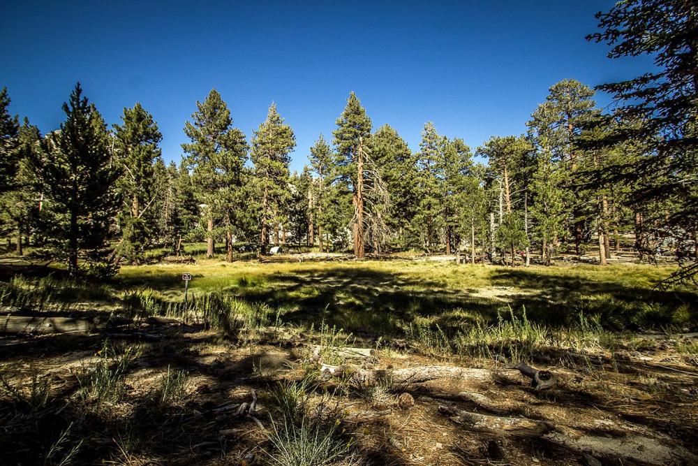
Mount San Jacinto State Park protects over 14,000 acres of alpine wilderness above Palm Springs, including more than 50 miles of maintained hiking trails. The park is known for its dramatic biodiversity, with desert landscapes transitioning into mixed-conifer forests, subalpine woodlands, and seasonal meadows.
Wildlife sightings may include mule deer, mountain chickadees, and occasionally bighorn sheep at lower elevations. In spring and early summer, wildflowers bloom throughout Long Valley and Round Valley.
Trail Stats: Mount San Jacinto Peak via Palm Springs Aerial Tramway
Difficulty: Strenuous (due to elevation gain and altitude)
Distance: 5.5 miles one way (11 miles round trip)
Elevation:
- Trailhead (Mountain Station): 8,516 ft
- Summit: 10,834 ft
- Total Elevation Gain: ~2,300 ft
Trail Type: Out-and-back
Best Season: May through October(Snow and ice are common November to April)
Permit Required: Yes – free, self-issued at Long Valley Ranger Station
Recommended Gear
Essentials (Year-Round):
- Sturdy hiking boots with good traction
- 2–3 liters of water per person
- Sun protection (hat, sunscreen, sunglasses)
- High-energy snacks or lunch
- Layered clothing (weather changes quickly)
Seasonal / Advanced Gear:
- Trekking poles (helpful for descent)
- Windproof jacket
- Map or GPS-enabled hiking app
- Microspikes or traction devices (winter/early spring)
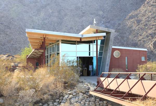
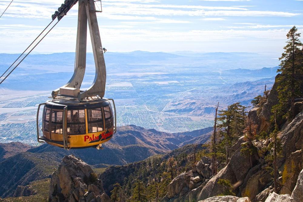
Getting There: Palm Springs Aerial Tramway
Begin your journey by taking the Palm Springs Aerial Tramway to the top of San Jacinto Mountain. This Tramway is the world’s largest rotating tram car, traveling along the cliffs of Chino Canyon and transporting you to the pristine wilderness of Mt. San Jacinto State Park.
- Ride Time: Approximately 10 minutes
- Distance: 2.5 miles
- Elevation at Mountain Station: 8,516 feet
- Experience: Rotating tram cars provide 360° views of the Coachella Valley, desert landscapes, and surrounding mountains.
Once at the top, hikers gain access to more than 50 miles of hiking trails, traversing diverse biotic communities from desert scrub to mixed-conifer forests dotted with seasonal wildflowers.
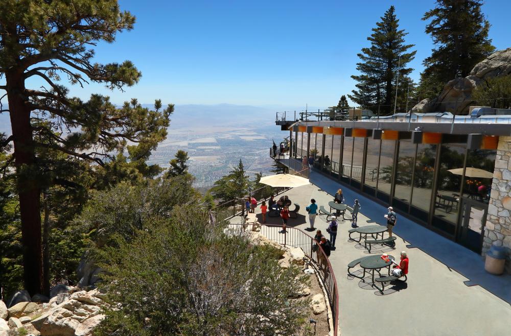
Dining at the Palm Springs Aerial Tramway
For hikers and visitors looking to enjoy food with a view, the Palm Springs Aerial Tramway Mountain Station offers several convenient and delicious dining options to refuel before or after your adventure to San Jacinto Peak.
Peaks Restaurant
A full-service restaurant with panoramic valley views.
- Seasonal California cuisine
- Hearty entrées, sandwiches, and salads
- Ideal for post-hike meals or special occasions
Pines Café
Perfect for hikers on the go.
- Grab-and-go sandwiches and wraps
- Trail snacks, fruit, and beverages
Tramway Snack Bar:
Quick refreshments for day visitors.
- Bottled water and light snacks
- Family-friendly, fast options
Permits & Trailhead Access
From the Mountain Station, walk down the paved switchbacks into Long Valley. Follow posted signs toward Round Valley and stop at the seasonal Long Valley Ranger Station to complete your self-issued wilderness permit.
Permits are required for all hikers entering the wilderness area.
As you continue on the trail, you’ll pass a couple of junctions. Follow the signs to Round Valley (or the summit).
San Jacinto Peak Trail Route Overview
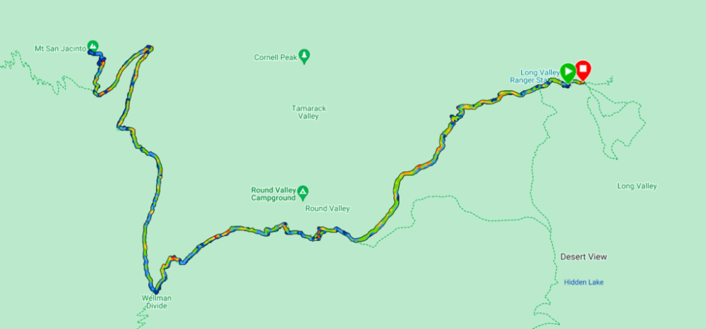
Long Valley to Round Valley
- Distance: ~2.3 miles
- Elevation: ~9,100 feet
Round Valley is a rare high-elevation meadow and an excellent rest point.
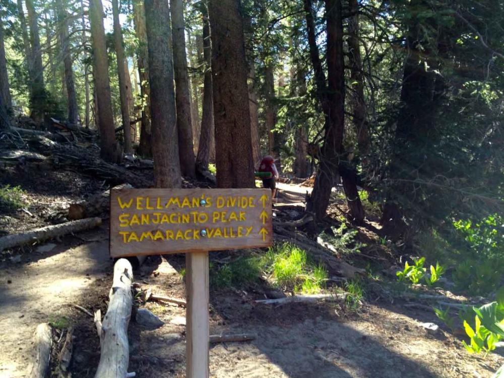
Round Valley to Wellman’s Divide
This section offers expansive southern views and a steady climb through pine forest.
Final Summit Push
From Wellman’s Divide, hikers traverse the east flank of Jean Peak. A brief flat section near 10,000 feet provides relief before the final ascent to the summit.
- Distance (Tram to Summit): ~5.5 miles one way
- Difficulty: Strenuous due to elevation
- Total Elevation Gain: ~2,300 feet
Seasonal Conditions & Weather Considerations
- Snow Season: November through April
- Best Hiking Season: May through October
- Weather Checks: (760) 327-0222
Snow, ice, and high winds are common in winter and early spring. Traction devices may be required during snowy conditions.
Source: Jeff Hester
Hiking San Jacinto Peak offers one of the most dramatic elevation changes accessible by tram anywhere in the world. From desert floor to alpine summit, the journey showcases why Palm Springs is a premier destination for outdoor adventure, hiking, and nature lovers.
Trail Safety & Wilderness Tips
- All natural and cultural features are protected by law
- Wilderness permits are mandatory
- Pack out all trash
- Use pit toilets where available
- Stay on designated trails to prevent erosion
- No dogs allowed (except trained service animals)
- No fires or smoking outside designated areas
- Weapons are prohibited in state wilderness areas
More Palm Springs Hiking Adventures:
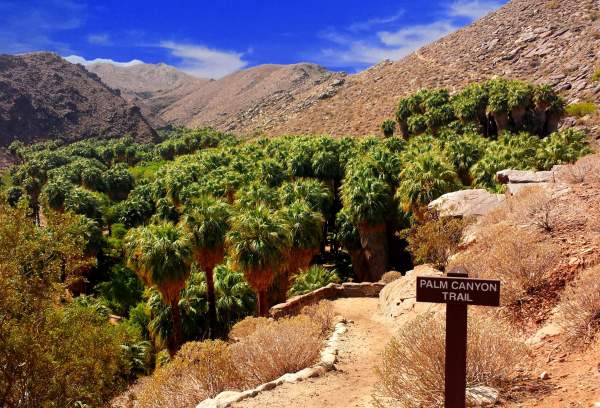
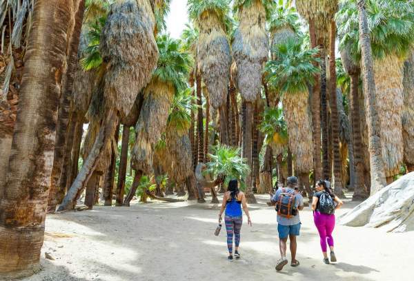
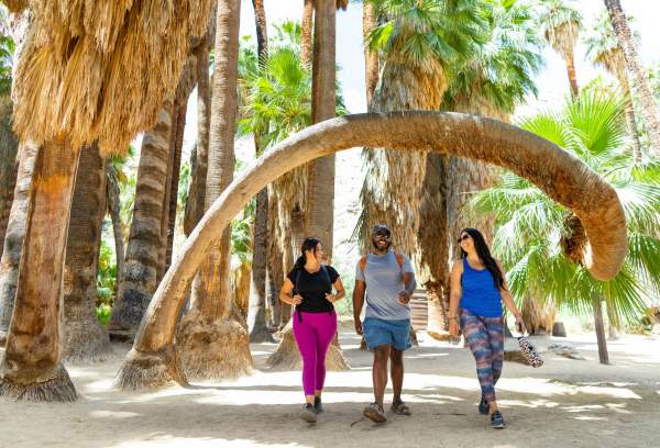
Hike Indian Canyons: A Complete Trail Guide to Sacred Oasis
Explore the Beauty of Lower Palm Canyon: A Family-Friendly 3-4 Mile Hike