Popular Trails, Scenic Views & Local Favorites
Whether you’re looking for a leisurely desert stroll, a waterfall hike, or a challenging summit climb, Palm Springs offers some of the best hiking trails in Southern California, many just minutes from downtown, the Art Museum, and local neighborhoods.
This guide highlights 10 of the most popular hikes in Palm Springs, featuring trails for every skill level. You’ll find routes with lush palm oases, panoramic mountain views, seasonal waterfalls, and iconic desert landscapes. Several hikes are located within Indian Canyons, while others climb into Mount San Jacinto State Park or start right in the heart of the city.
Each hike below includes distance, difficulty, elevation gain, dog policies, and insider tips to help you choose the right trail for your adventure.
Quick Guide: Palm Springs Hiking Trails
- Best Easy Hikes: Andreas Canyon, Tahquitz Canyon Loop, Desert View Trail
- Best Moderate Hikes: Murray Canyon to Seven Sisters Falls, Victor Loop
- Best Challenging Hikes: San Jacinto Peak, South Lykken Trail, Cahuilla Peak
- Best Waterfall Hikes: Tahquitz Canyon, Murray Canyon
- Best Downtown Trails: Museum Trail, North Lykken Trail
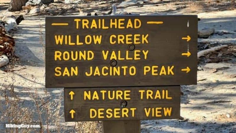
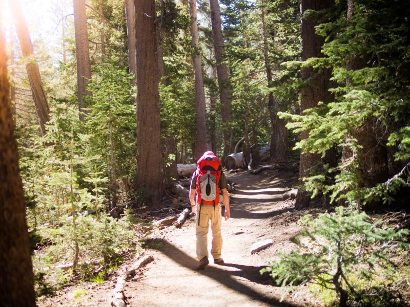
1. San Jacinto Peak (via Palm Springs Aerial Tramway)
Hard | 10 miles out-and-back | Elevation Gain: 2,578 ft | No Dogs | Fee Required
Getting There: Begin your hiking adventure by purchasing tickets and taking the Palm Springs Aerial Tramway up to the Mountain Station at 8,516 feet. This is where you will begin your hike, and it is also one of the thrills of this adventure.
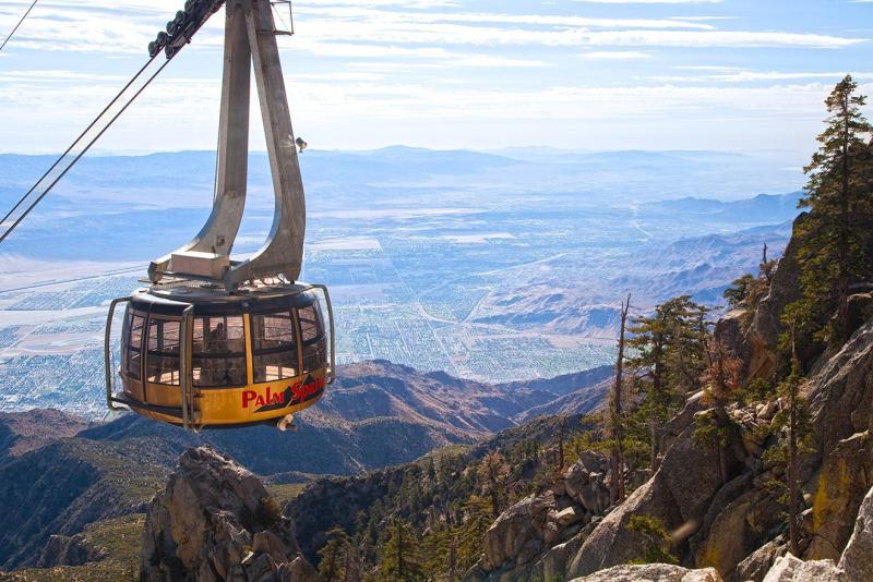
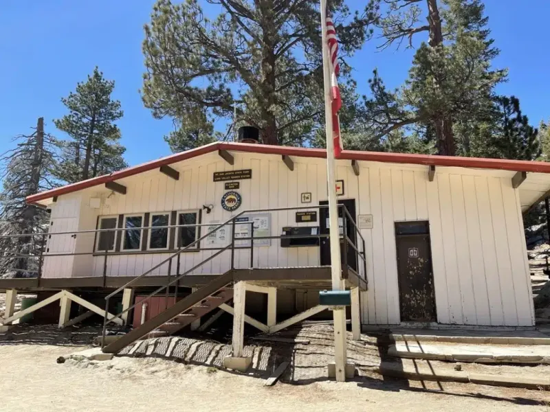
Before you start your hike, obtain a wilderness permit at the Long Valley Ranger Station near the Mountain Station. This permit is required for all hikers planning to enter the San Jacinto Wilderness and is free. Fill out the permit, drop the blue copy in the box, and keep the white copy. Return the white copy on your return.
Description: As you set out on your hike, carry essential gear, including plenty of water, snacks, sunscreen, a hat, sturdy hiking shoes, and layered clothing. The temperatures can vary significantly, usually about 30 degrees cooler, so be prepared for changing weather conditions.
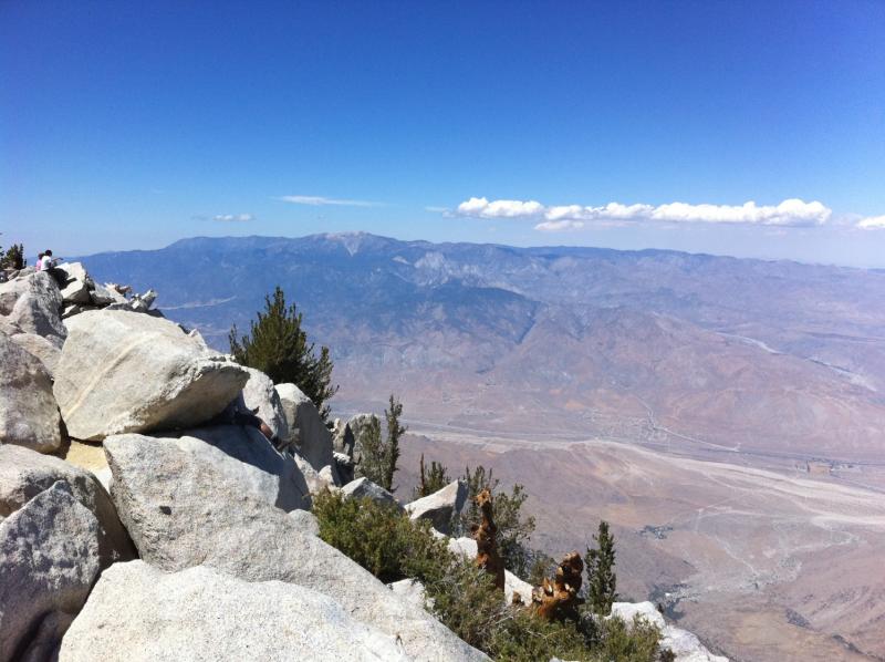
San Jacinto Peak stands at an elevation of 10,834 feet; therefore, it's essential to pace yourself and take breaks as needed. Altitude sickness can be a concern for some hikers, so listen to your body and acclimatize accordingly.
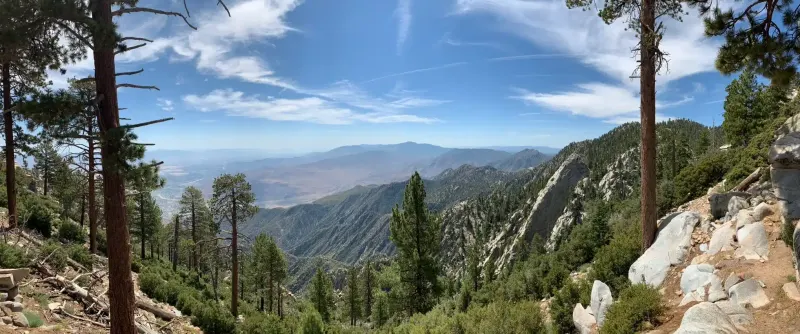
The trail is well signed, but be sure to pay attention, as there are other trails nearby. You will wander through some magnificent boulder formations. When you reach the Wellman Divide junction, keep north. On a clear day, you will have a view of the Salton Sea. As you approach the peak, the trail turns into a boulder formation.
Soon, you will see the refuge hut built in 1933, which is considered the highest building in Southern California. Feel free to review it and leave any extra supplies you have.
Once you reach San Jacinto Peak, take a moment to soak in the breathtaking panoramic views of the surrounding mountains, desert landscape, and sometimes even the Salton Sea. It's an enriching experience, which is why it's on the list of the most popular Palm Springs hikes.
After enjoying your time at the peak, begin your descent using the same trail you took up. Remember to take your time and carefully navigate any steep sections or loose terrain.
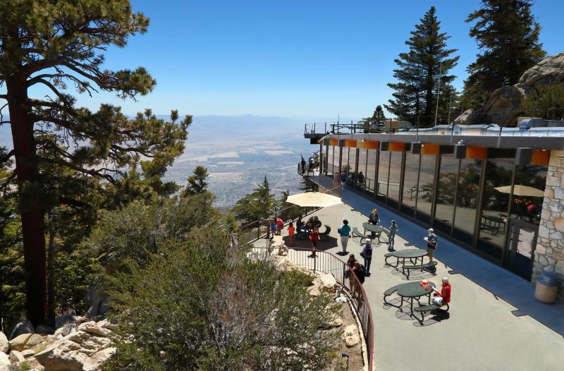
Once you're back at the Mountain Station, take advantage of the amenities available, such as the Peaks Restaurant or the various observation decks. It's a great way to relax and reflect on your hiking adventure.
Best Time to Hike: Late spring through early fall, weather permitting.
2. Desert View Trail (Mount San Jacinto State Park)
Easy | 2-mile loop | Elevation Gain: 334 ft | No Dogs | Kid-Friendly | Fee Required
Getting There: Begin your hiking adventure by purchasing tickets and taking the Palm Springs Aerial Tramway up to the Mountain Station at 8,516 feet. It is a quick 10-minute ride up the mountain.
Description: Located at the top of the Palm Springs Aerial Tramway, the park has plenty of trails, like the Round Valley Loop and paths up to the summit for longer hikes. The Desert View Trail is a shorter walk with only 334 feet of total elevation gain, making it ideal for families and those with less ambitious hiking plans. Plus, this hike offers incredible scenic views.
Once you’ve left the Mountain Station and descended the paved walkway, the trailhead for the Desert View Trail will be on your left. The trail is a quick 1.5-mile route that leads past five viewpoints. Each has a different orientation, so each is worth a quick stop. Best of all, this is a loop, so you’ll end up at the base of the paved path, where you can decide to continue hiking on another trail or head up to the Mountain Station and have some lunch.
Best Time to Hike: Year-round; ideal for first-time visitors.
Credit: Sam Miller
3. Tahquitz Canyon Loop
Easy | 2-mile loop | Elevation Gain: 324 ft | No Dogs | Kid-Friendly | Fee Required
Getting There: Head west on Mesquite, and it will take you to the Aqua Caliente Tahquitz Visitor Center at 500 W. Mesquite Avenue. There is free parking.
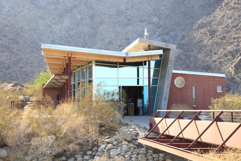
Tickets: Tahquitz Canyon is on the Agua Caliente Band of Cahuilla Indians reservation. You can purchase your $12.50 ticket at the Visitor Center. The fee helps protect and preserve the land, reducing the risk of accidental damage. The price also includes a ranger-led interpretive hike. You can also pick up a map. Admission/Hours
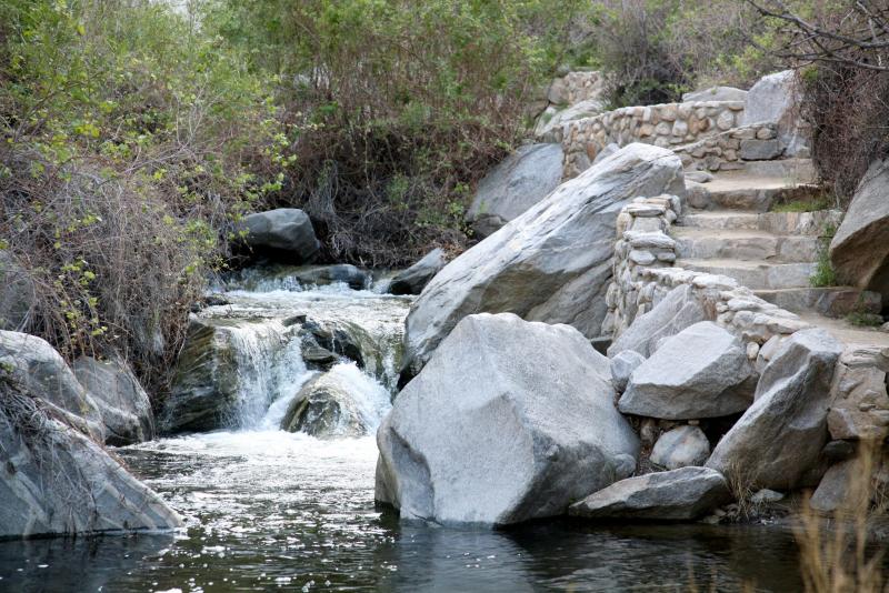
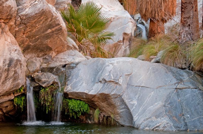
Trail Highlights: One of the highlights of this hike is the breathtaking 50-foot-tall Tahquitz Falls. The waterfall cascades down the rocks during the rainy season, creating a spectacular sight. Remember to bring your camera to capture this natural wonder.

Description: Tahquitz Canyon holds significant cultural importance to the Agua Caliente Band of Cahuilla Indians. As you hike, you'll encounter signs that share information about Native American history and heritage. Please respect these cultural landmarks and leave no trace behind.
Throughout the trail, you'll discover several viewpoints offering panoramic vistas of Palm Springs and the surrounding Coachella Valley. There are also a couple of water crossings with lovely bridges. The paths are well-maintained.
Begin your hike early in the morning to beat the heat and crowds. This will allow you to enjoy the tranquility and serenity of the canyon fully.
Best Time to Hike: Winter and spring, when water is flowing.
4. Palm Springs Art Museum to North Lykken Trail
Hard | 4.3 miles out-and-back | Elevation Gain: 1,745 ft | No Dogs | No Shade
Getting There: The trail begins at the parking lot north of the Palm Springs Art Museum. There is free parking across the street.
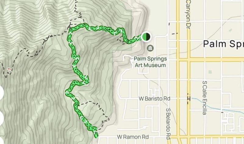
Description: Carl Lykken was a Palm Springs pioneer who owned the city's first retail store. He was very involved with the city and enjoyed the outdoors. His initial efforts led to the creation of some of the first official hiking trails in Palm Springs.
The first section of the trail that leaves the Museum runs through private property but is well marked. When passing through private property easements and right-of-ways, staying on the path and respecting posted guidance is especially important. Local officials and private landowners are partners in providing public access to this area. Staying on the route while on personal property helps ensure that agreements between local officials and the landowner are upheld and that the trail remains open to the public in the future.
Best Time to Hike: October through April; start early.
The trailhead ends on Ramon Road, near the intersection with Belardo Road. Conversely, you can begin your hike here.
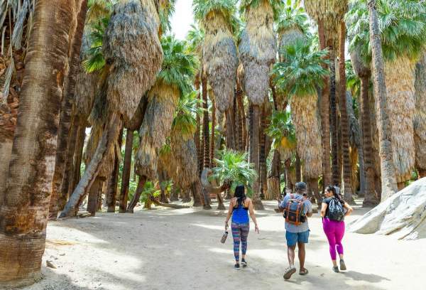
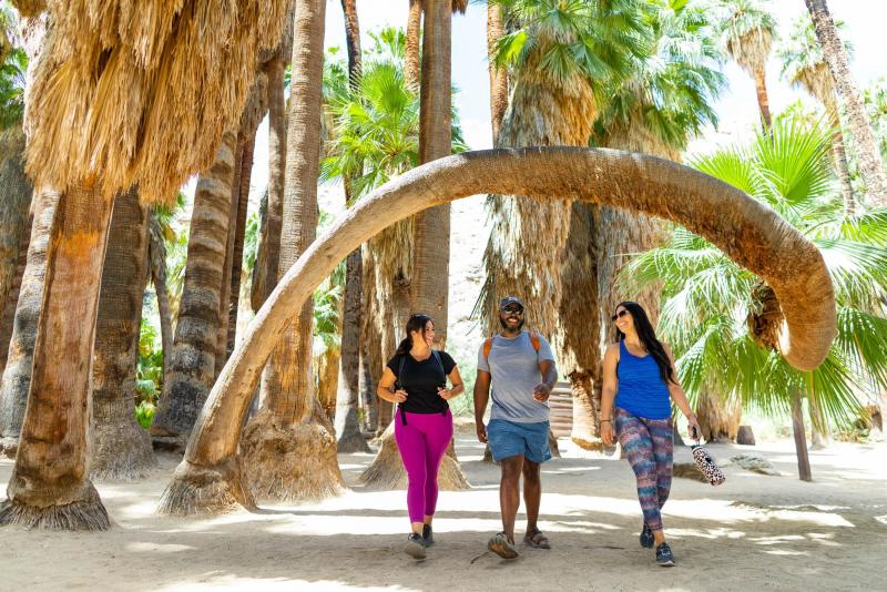
5. Andreas Canyon Loop
Easy | 1-mile loop | Elevation Gain: 177 ft | No Dogs | Kid-Friendly | Fee Required
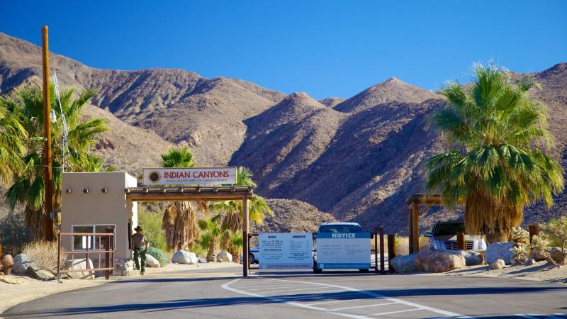
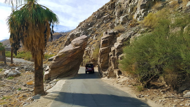
Getting There: Andreas Canyon is located within the Indian Canyons, which are part of the Agua Caliente Band of Cahuilla Indians' reservation. Purchase your entry at the entrance located at 38520 S. Palm Canyon. The entrance to Andreas Canyon will be on your right after you enter the reservation. Follow the road to the parking lot.
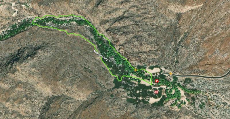
Description: This picturesque one-mile loop trail offers hikers a chance to immerse themselves in the beauty of nature and experience the unique desert oasis that is Andreas Canyon. Whether you're a seasoned hiker or just starting your outdoor adventures, this trail is perfect for all skill levels.
The trail begins at the Andreas Canyon parking lot, which has ample parking and restroom facilities.
As you meander along the trail, the soothing sound of rushing water will accompany you. Andreas Creek flows alongside the path, providing a peaceful ambiance and attracting a variety of bird species.
Be sure to stop by to view the many Andreas Canyon Rock homes and historic structures owned by club members, which can only be sold through the club. This stone building serves as a poignant reminder of the Native American presence in the area, adding an extra layer of cultural significance to your hike.
The trail continues with several bridges crossing the creek, offering breathtaking views of the crystal-clear water below.
Best Time to Hike: Fall through spring.
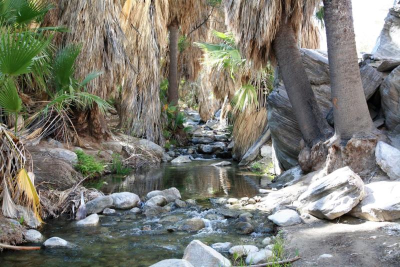
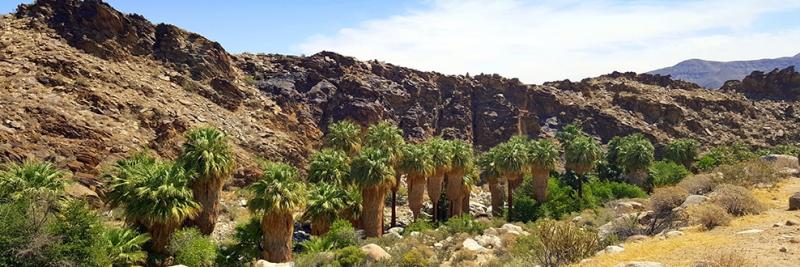
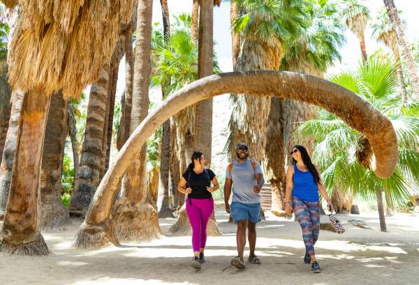
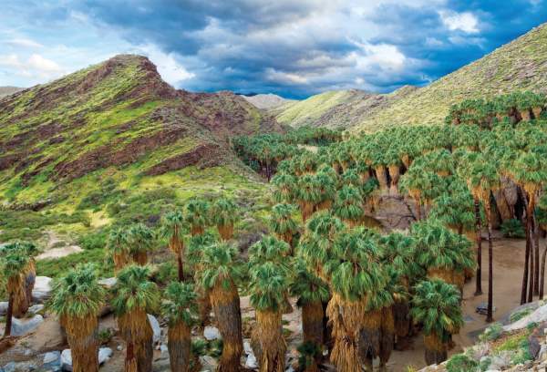
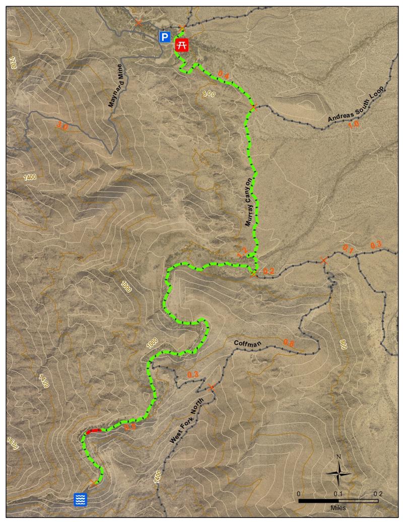
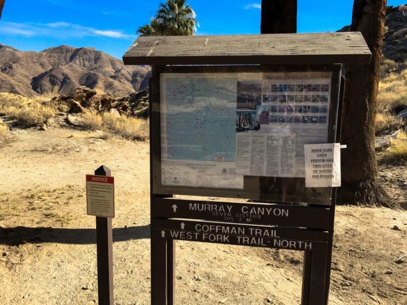
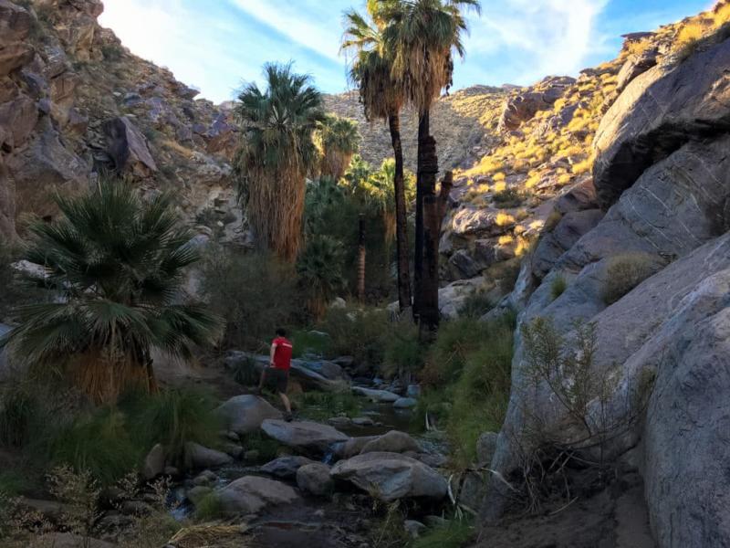
6. Murray Canyon Trail to Seven Sisters Falls
Moderate | 3.7 miles out-and-back | Elevation Gain: 538 ft | No Dogs | Kid-Friendly | Fee Required
Getting There: Murray Canyon is located in the Indian Canyons, which are part of the Agua Caliente Band of Cahuilla Indians' reservation. Purchase your ticket at the entrance located at 38520 S. Palm Canyon. The entrance to Murray Canyon is via Andreas Canyon. Take the first right upon entering the reservation. Follow the road to the parking lot. You will be provided with a map upon entering Indian Canyons.
Description: As you start your hike, take a moment to appreciate the natural beauty surrounding you. The trail is well-maintained and offers a mix of shade and sun, making it ideal for hikers of all skill levels.
As you go along the trail, you'll be greeted by magnificent desert landscapes, towering palm trees, and occasional glimpses of wildlife.
After about 2 miles of hiking, you'll reach the hike's highlight – Seven Falls. This series of cascading waterfalls is a true natural wonder, providing a refreshing oasis in the desert.
If you're feeling adventurous and want to explore further, you can continue beyond Seven Falls to discover more of Indian Canyons. Several additional trails offer different levels of difficulty and scenery. Just remember to plan accordingly and be mindful of your energy levels.
Best Time to Hike: Winter and early spring after rainfall.
Credit Casey Schreiner
The Murray Canyon Trail to Seven Falls in Indian Canyons is a truly unforgettable experience.
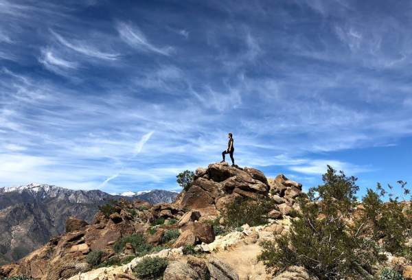
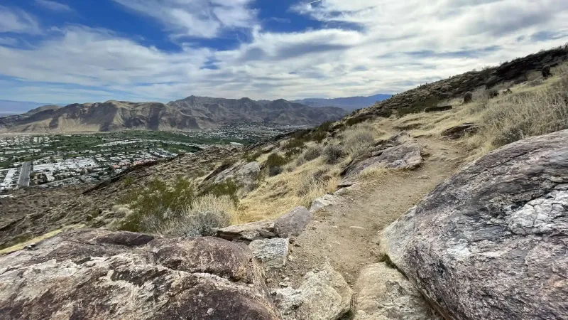
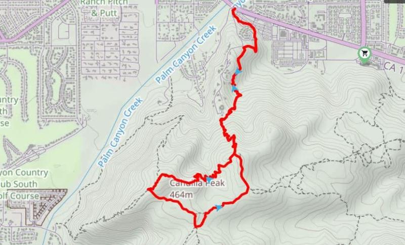
7. South Lykken Trail
Moderate to Hard | 8.9 miles out-and-back | Elevation Gain: 2,208 ft | No Dogs
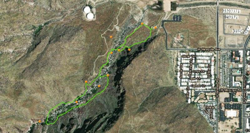
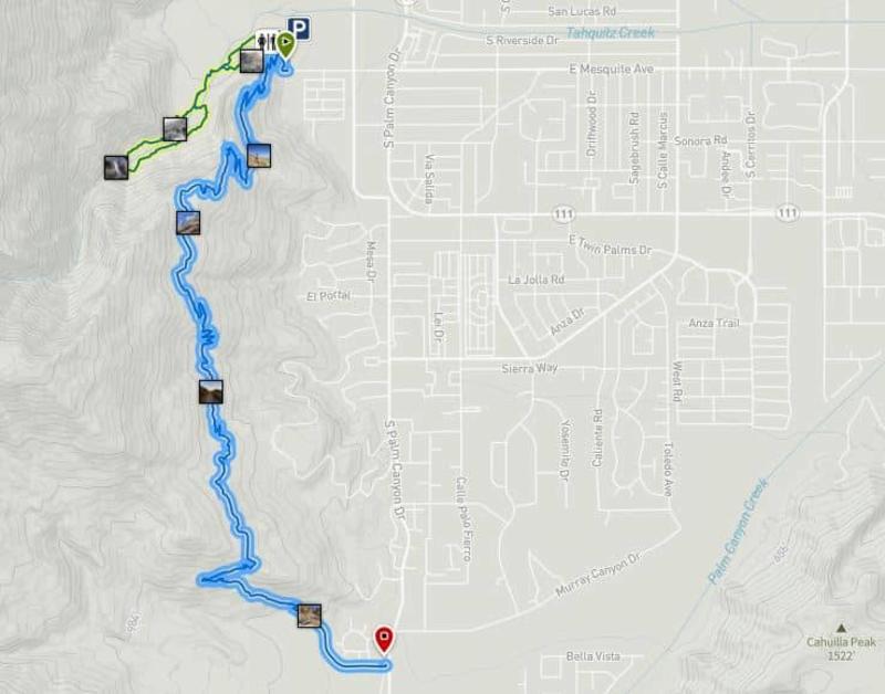
Getting There: Head west on Mesquite, and it will take you to the Aqua Caliente Tahquitz Visitor Center at 500 W. Mesquite Avenue. The trailhead is located just at the curve of Mesquite, near the parking lot. You should be able to find parking along Mesquite. The trail ends on South Palm Canyon just south of Murray Canyon Drive. In the map above, the green line represents the Tahquitz Canyon Loop hike, and the blue line represents the South Lykken Trail.
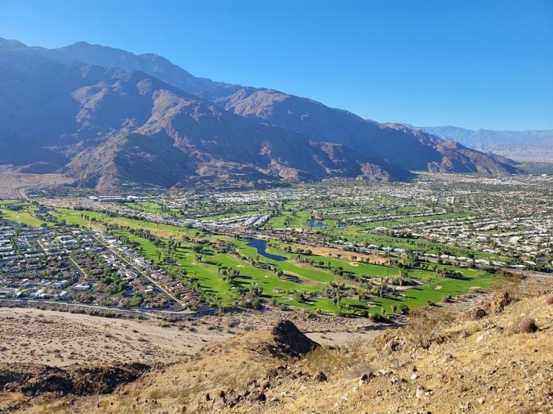
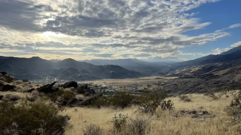
Description: Many consider this to be one of the best trails in Palm Springs. As you begin your ascent, be prepared to encounter panoramic vistas at every turn. The South Lykken Trail offers sweeping views of Palm Springs, the desert oasis, and the surrounding mountain ranges.
While the South Lykken Trail is not recommended for beginners, it offers a rewarding challenge for experienced hikers. The trail features steep inclines and rocky sections, demanding physical stamina and mental focus.
Best Time to Hike: October through April.
Credit: Timothy State
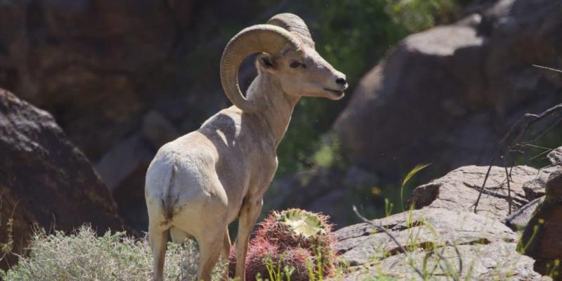
One of the most exciting aspects of hiking the South Lykken Trail is the opportunity to spot a diverse array of wildlife. Keep your eyes peeled for desert species such as bighorn sheep, roadrunners, and even the occasional coyote. Remember to maintain a respectful distance and observe these creatures in their natural habitat.
Credit: Rob Bignell
Credit: Timothy State
8. Museum Trail
Hard | 1.6 miles out-and-back | Elevation Gain: 833 ft | No Shade
Getting There: The trail begins at the parking lot north of the Palm Springs Art Museum, thus the trail name. There is free public parking across the street. Please refrain from using the Art Museum parking lot. This is also the entry for the North Lykken Trail, but it heads in a different direction.
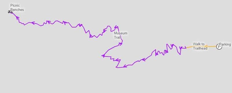
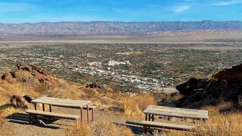
Description: You can watch for various highlights as you make your way along the Museum Trail. The trail winds through a picturesque desert landscape, showcasing native flora and fauna. You'll also encounter interpretive signs providing interesting information about the local ecosystem and wildlife. The trail follows a straight path up the mountain spine to a picnic bench and a vista point.
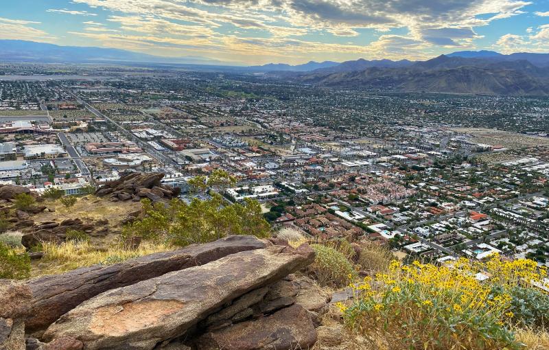
One of the trail's highlights is the Vista Point, located about halfway through the hike. This scenic overlook offers panoramic views of the Coachella Valley, Palm Springs, and the surrounding mountains.
Best Time to Hike: Cooler months only; early morning recommended.

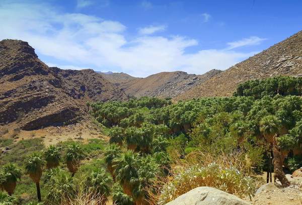
9. Victor Loop (Palm Canyon)
Moderate | 3-mile loop | Elevation Gain: 365 ft | No Dogs | Fee Required
Getting There: Victor Loop is part of Palm Canyon, located in the Indian Canyons, which are located on the reservation of the Agua Caliente Band of Cahuilla Indians. Purchase your entry at the entrance toll gate located at 38520 S. Palm Canyon. Follow the road south, and you will go between two boulders and head up a hill to the Trading Post, where you can park.
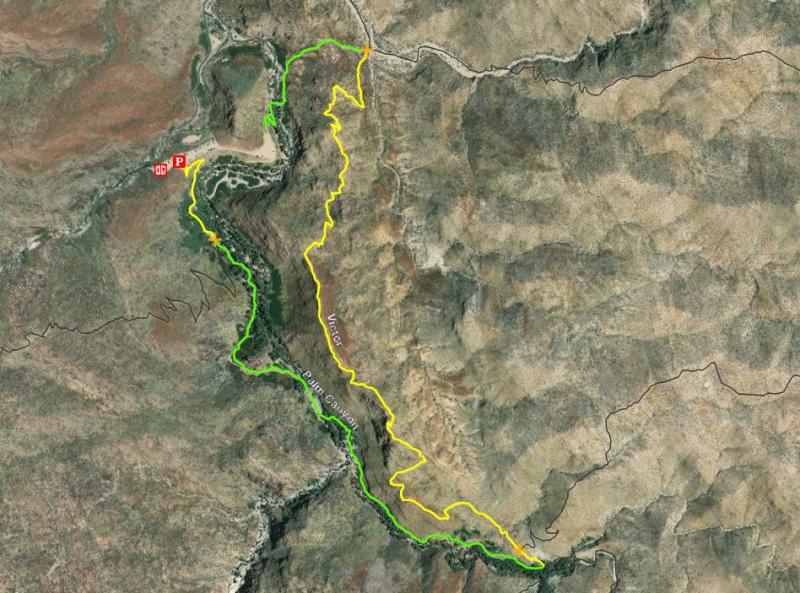
Description: This trail is one of the most scenic trails in the Indian Canyons, which is why it's one of the most popular Palm Springs hikes. It is best to access this trail by hiking a mile south on the Palm Canyon Trail. The Victor Trail will take the hiker out of the shade of the palm trees, up onto the ridge overlooking the canyon, and back to the Trading Post, creating a three-mile loop.
The meandering creek and granite boulders are worth a slower pace, and the peace of this canyon is palpable. Take your time to explore it because once you start climbing out of the canyon and join the exposed Victor Trail, you’ll want to pick up your pace. This loop is a tale of two ecosystems, and the second half is entirely desert; it is equally beautiful in its own way, but the risk of heat and sun exposure is real.
The Victor Trail winds back northward on the ridge above the creek, offering big views down the canyon and the occasional glimpse into the Coachella Valley.
Best Time to Hike: Winter and spring.
Palm Canyon
10. Cahuilla Peak via Araby Trail
Hard | 5 miles out-and-back | Elevation Gain: 1,519 ft | No Dogs | Limited Shade
Getting There: Park at Rim Road off E. Palm Canyon. Parking can be limited.
Description: The beginning of the trail goes above a residential area for about 1/4 mile. The exclusive Southridge Drive will be on your right.
As you continue hiking, the path becomes steeper and more challenging. Take your time and enjoy the panoramic vistas of the Coachella Valley and the San Jacinto Mountains that will start to unfold before you. The stunning views will serve as a rewarding backdrop for your ascent.
After a few miles, you'll reach a saddle where the Araby Trail intersects with the Garstin Trail. You can stay on the Araby Trail, following the signposts that lead to Cahuilla Peak. From here, the trail gets steeper and more rugged, requiring some scrambling in certain sections. Take caution and proceed with care.
As you near the summit, the effort put into the climb will be well worth it. At the peak of Cahuilla, you'll be treated to unobstructed views of the entire Palm Springs area and the picturesque Coachella Valley below.
Best Time to Hike: Late fall through early spring.