Explore Scenic Trails & Desert Views
Discover the top hiking trails in Palm Canyon, from easy palm groves to challenging backcountry loops, all starting at the Trading Post.
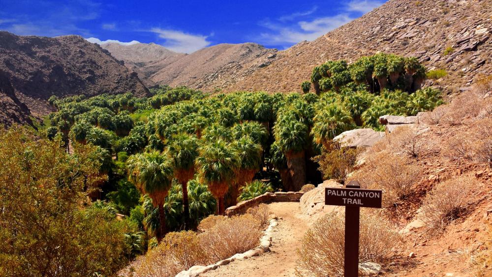
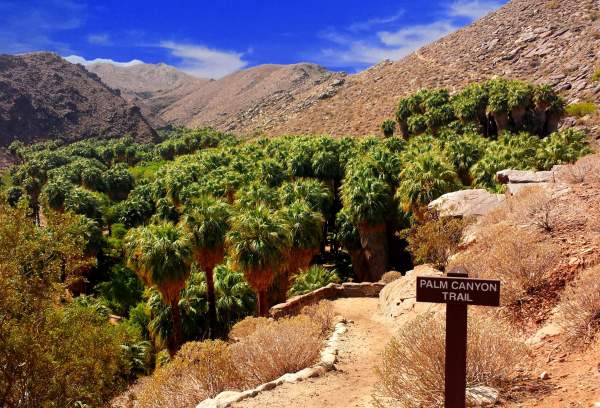
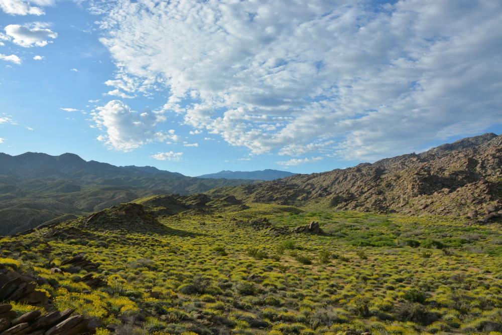
Explore Palm Canyon Hiking Trails
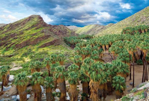
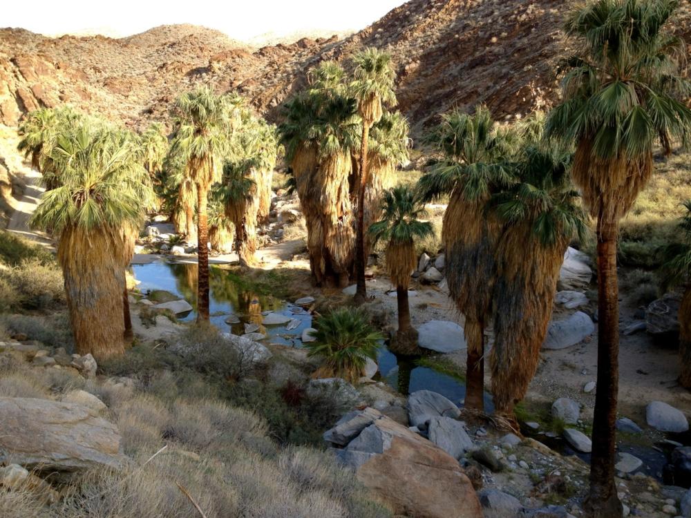
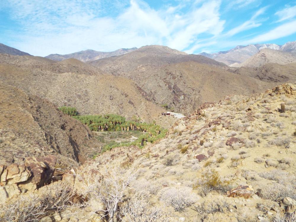
Palm Springs’ Indian Canyons offer some of the most scenic hiking in Southern California. Starting at the Palm Canyon Trail near the Trading Post, hikers can explore lush palm groves, desert landscapes, and stunning vistas of the San Jacinto Mountains.
Location & Access:
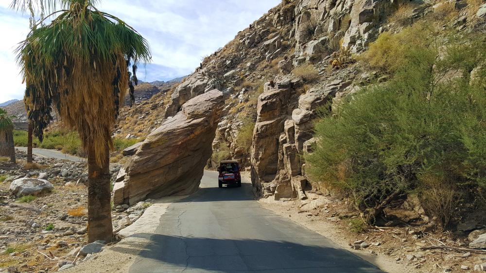
Enter Indian Canyons via South Palm Canyon Drive and follow the signs to Indian Canyons. From downtown, stay to the right on South Palm Canyon when the road curves left to East Palm Canyon. The tollgate is at 38520 S. Palm Canyon Drive, just a couple of miles further. From the tollgate, proceed 2.5 miles to the Palm Canyon parking lot, where the trading post is located high on a ridge. There is a nice vista view of the city from this vantage point. A trail map is available at the tollgate. Online Trail Guide
Note: There is a fee for entrance into Indian Canyons. You can purchase tickets online in advance.
Top Palm Canyon Trails
Fern Canyon Trail
- 3.5 Miles
- Moderate
- Starts left of the main Palm Canyon Trail, crosses Palm Canyon Creek, and features lush fern groves.
- Highlights: Views of South Palm Canyon, Hermit’s Bench, and the San Jacinto Mountains.
- Tip: Connect to Vanderventer or Hahn Buena Vista Trails for a scenic loop.
The trail begins to the left of Palm Canyon Trail. It turns right and crosses over Palm Canyon Creek. After 1 mile, you will reach the area where ferns grow, especially in a wet winter. It offers excellent views of the South Palm Canyon near Hermit’s Bench and good vistas of Palm Springs and the San Jacinto Mountains.
You can hike back to the trading post for an out-and-back hike, or you can access Vanderventer Trail and the Hahn Buena Vista Trail from the Fern Canyon Trail for a longer scenic hike loop.
Palm Canyon Trail to the Stone Pools
Palm Canyon to Stone Pools Map
- 6 miles
- Moderate
- Follows the creek to the Stone Pools, a series of natural water pools.
- Highlights: Palm groves, creek crossings, and desert oasis scenery.
- Tip: Water flow depends on seasonal rainfall.
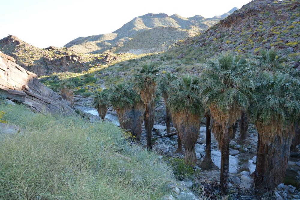
Drop down into Palm Canyon from the trading post and continue south for about a half mile until you cross Palm Canyon Creek to your left. Follow the creek another .5 miles until you reach the marker indicating the trail crosses the stream and climbs up the south bank. Soon, the trail will open to a magnificent view of the canyons.
Hike 2 miles, and you will reach a dirt-wash road. Take the trail straight ahead rather than following the wash. Follow the trail 1 mile, and you will arrive at a point where it fades into the sandy rock but remains visible. Turn right toward the canyon bottom, and it will lead you to an area known as the Stone Pools along Palm Canyon Creek.
In a wet year, water flows freely and deep, often creating a series of small pools. In a dry year, water is sporadic.
Credit: Brian Dearth
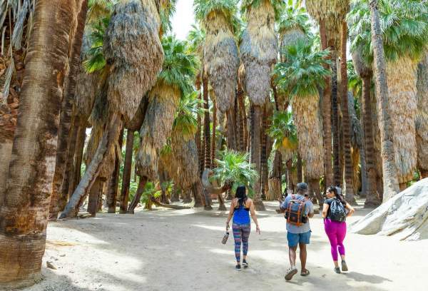
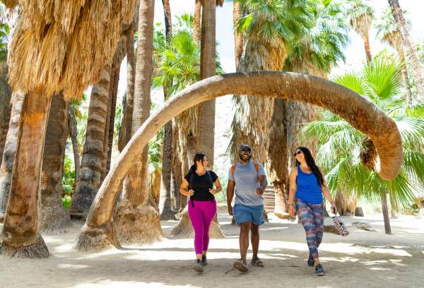
Lower Palm Canyon Trail
- 4 miles
- Easy
- A gentle hike along the creek with an impressive concentration of palms and cottonwoods.
- Highlights: Ideal for beginner hikers and families.
- Tip: Connect with Victor or Palm Canyon Trails for extended routes.
For the first .75 mile, you will be hiking just above the creek. Enjoy the incredible concentration of palm trees, cottonwoods, and desert plants. The trail will then drop down to the creek and cross over to the left. In a wet year, the creek water level can be high.
This is an excellent introduction to desert hiking, which requires only modest effort. For longer and more strenuous hikes, hike through the palm groves and connect with the Victor or Palm Canyon Trail.
Victor Trail / Fern Canyon
- 2.5 – 5 miles
- Easy
- Scenic loop offering creek crossings and desert vistas.
- Highlights: Giant ferns (in wet winters) and panoramic canyon views.
Head down the Palm Canyon trail, hike .5 miles, and cross over the creek. In another .5 mile, you will see the Victor Trail. You can hike up the hill to your left and see great views of Palm Canyon below and the mountains in the distance. After 1 mile, you will drop back down into Palm Canyon and follow the stream back to the trading post.
Another option is to continue north until you reach the sign for the Fern Canyon Trail. This hike is excellent to do when the water is flowing because you will see the giant ferns that inhabit the area. Then, turn around and head back to the post for an out-and-back hike.
East Fork / Fern Canyon Loop Trail
- 7.5 miles
- Moderate
- Explores backcountry areas east of Palm Canyon.
- Highlights: Sandy-bottom canyons, ridge views, and Fern Canyon access.
This hike takes you into the backcountry east of Palm Canyon. Follow the Palm Canyon Trail for .5 miles and cross over the creek. Continue east at the junction, and it becomes the East Fork Trail. For the next 2 miles, you will be walking in a sandy-bottom canyon, steadily gaining elevation until you reach the Vanderventer Trail. Then, turn left and hike 2 more miles along a ridge that occasionally drops into and out of small washes and canyons. Follow the signs toward Fern Canyon and the trading post.
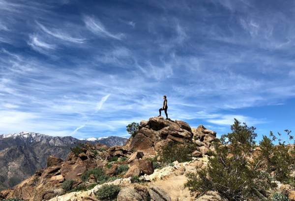
West Fork Trail to Andreas Canyon
- 10 miles
- Experienced
- Requires a car shuttle; climbs steadily toward the Pacific Crest Trail and Desert Divide.
- Highlights: Murray Canyon overlooks, creek crossings, and rugged desert terrain.
This hike ends at Andreas Canyon, not at the Palm Canyon Trading Post.
The West Fork Trail climbs steadily upward out of Palm Canyon toward the Pacific Crest Trail and Desert Divide, 6,000 feet above the valley floor. Look for the signpost that marks the beginning of the trail. This trail is steep and strenuous, so be prepared by taking plenty of water and avoiding hiking on hot days.
After 2 miles, take the right-hand trail. This will lead you to a stream. As you continue, you will emerge overlooking Murray Canyon. The trail then descends and crosses several streams. The trail eventually joins Murray Canyon, then continues to Andreas Canyon.
Palm Canyon to Indian Potrero
Palm Canyon to Indian Potrero Map
- 9 miles
- Moderate
- Traverses palms, creeks, and wide canyon vistas.
- Highlights: Seasonal streams, panoramic mountain views, and desert flora.
Head down the Palm Canyon trail and head toward the large grove of palms and picnic tables to the south. Follow the creek for .5 miles, cross over, and walk along the canyon bottom. In about another .5 mile, you will see a sign for the Indian Potrero Trail. Cross over and begin to climb to the wide-open views of the canyon and mountains.
In the winter, there is a generous stream to enjoy. The trail eventually meets back up with the Palm Canyon Trail, and you can return on the same trail.
Planning Your Palm Springs Hike
Palm Canyon hiking trails offer something for every skill level, from easy walks along the creek to challenging backcountry loops.
Remember to:
- Bring plenty of water and sun protection.
- Wear sturdy shoes and layered clothing for changing temperatures.
- Respect the natural environment and stay on designated trails.
Palm Canyon is a desert oasis where hikers can experience the natural beauty, history, and tranquility of Palm Springs’ Indian Canyons with every step.